place

Siege of Quebec (1760)

1760 in New France1760 in North AmericaAC with 0 elementsBattles involving CanadaBattles involving France
Battles involving Great BritainBattles of the French and Indian WarConflicts in 1760Conflicts in CanadaHistory of Quebec CitySieges involving FranceSieges involving Great Britain
A view of the City of Quebec, the capital of Canada (…) by Captain Hervey Smyth Vue de la ville de Québec, capitale du Canada (…) par le Capt Harvey Smyth P Benazech sculp

The Siege of Quebec, also known as the Second Siege of Quebec, was a French attempt to retake Quebec City, in New France, which had been captured by Britain the previous year. The siege lasted from 29 April to 15 May, when British ships arrived to relieve the city and compelled the French commander, Francis de Gaston, Chevalier de Lévis, to break off the siege and to retreat. The British launched the Montreal Campaign a few months later, which resulted in the city's capture. French resistance ceased, and the British Conquest of Canada was complete, as was confirmed in 1763 by the Treaty of Paris.

Excerpt from the Wikipedia article Siege of Quebec (1760) (License: CC BY-SA 3.0, Authors, Images).

Siege of Quebec (1760)
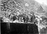
Promenade des Gouverneurs, Quebec

Geographical coordinates (GPS) Address Website Nearby Places
placeShow on map

Wikipedia: Siege of Quebec (1760)Continue reading on Wikipedia

Geographical coordinates (GPS)

Latitude Longitude
N 46.8075 ° E -71.2075 °
placeShow on map

Address

La Citadelle de Québec

Promenade des Gouverneurs
G1R 4A8 Quebec (La Cité-Limoilou)
Quebec, Canada
mapOpen on Google Maps

Website
lacitadelle.qc.ca

linkVisit website

A view of the City of Quebec, the capital of Canada (…) by Captain Hervey Smyth Vue de la ville de Québec, capitale du Canada (…) par le Capt Harvey Smyth P Benazech sculp
Share experience

Nearby Places

Ramparts of Quebec City

The ramparts of Quebec City is a city wall that surrounds the western end of Old Quebec's Upper Town in Quebec City, Quebec, Canada. The ramparts date back to the 17th century, with the ramparts having undergone a succession of modifications and improvements throughout its history. The city walls extends 4.6 kilometres (2.9 mi), with the southern portions of the ramparts forming a part of the Citadelle of Quebec. The ramparts were first built in 1690 in order to defend the Upper Town of Quebec City. In 1745, the walls were rebuilt further west, modelled after designs created by Gaspard-Joseph Chaussegros de Léry. The ramparts withstood several sieges during the mid-18th century, with British forces holding out in the walled city during the French siege of Quebec in 1760, and the American siege of Quebec in 1775. From the 1820s to 1830s, the British expanded and improved the ramparts and the rest of the city's defensive network. However, by the late-19th century, several deteriorating facilities associated with Quebec City's fortifications were demolished, although the primary defences remained. In 1948, the ramparts were designated as a part of the larger Fortifications of Québec National Historic Site. The fortifications, alongside the rest of Old Quebec, were designated as a UNESCO World Heritage Site in 1985; with the area serving as the only intact example of a fortified colonial settlement in North America north of Mexico.