place

Smith Creek (Woodbridge Township, New Jersey)

Bodies of water in Woodbridge Township, New JerseyRivers of Middlesex County, New JerseyRivers of New Jersey
Smith Creek, Woodbridge Township, New Jersey

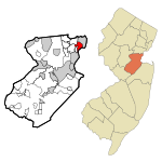
Smith Creek is a stream in Woodbridge Township, New Jersey, United States, emptying into the Arthur Kill 0.5 miles (0.80 km) north of the Woodbridge River. It was named for John Smith, one of the group who in 1667 purchased the land parcel from Governor Philip Carteret that became Woodbridge. Its navigable length is 0.6 miles (0.97 km), and there are nine marinas in that stretch. The creek draws less than 3 to 3.5 feet (0.91 to 1.07 m) of water, limiting its use to shallow draft boats. Dredging of the creek in the region of the marinas was a 2013 priority for Woodbridge Township after Hurricane Sandy. The creek is a "minor freshwater tributary" to Arthur Kill, with higher flows in the spring, and less in late summer and fall. Public Service Enterprise Group has a generating station 0.6 miles (0.97 km) north of the mouth of Smith Creek. One mile north of the mouth is an oil refining and storage facility. In 2013 "corrective action" was taken against the Hess Corporation, after selling the property, for soil and groundwater contamination, including arsenic, lead and benzene. An old reference states: Transatlantic sailing vessels once docked in Woodbridge, but silt from the clay pits converted Smith Creek into an inconsequential brook. Until the 1880s Woodbridge was a fashionable watering place. The Arthur Kill is now so spoiled by oil and sewage even gulls avoid it.

Excerpt from the Wikipedia article Smith Creek (Woodbridge Township, New Jersey) (License: CC BY-SA 3.0, Authors, Images).

Smith Creek (Woodbridge Township, New Jersey)
Cliff Road,

Geographical coordinates (GPS) Address Nearby Places
placeShow on map

Wikipedia: Smith Creek (Woodbridge Township, New Jersey)Continue reading on Wikipedia

Geographical coordinates (GPS)

Latitude Longitude
N 40.5497 ° E -74.2548 °
placeShow on map

Address

Cliff Road
07077
New Jersey, United States
mapOpen on Google Maps

Smith Creek, Woodbridge Township, New Jersey
Share experience

Nearby Places

Heards Brook
Heards Brook

Heards Brook is a stream in Woodbridge Township, Middlesex County, New Jersey, United States.The brook has a watershed of about 135 acres, flowing eastward through Woodbridge for 1.8 miles and draining into Woodbridge Creek, which flows southward into Arthur Kill. There is a history of tidal flooding along this creek and its tributary Heards Brook. The most extreme flooding occurred during Superstorm Sandy, with a high water mark in Woodbridge Creek of 12 feet. Where the brook enters the creek there is only a six-foot elevation above sea level. Heards Brook has been described, also, as having a "high flow, flashy nature"; in addition to tidal flooding, fluvial flooding is also common. The land is relatively impervious, and flooding is exacerbated by steep slopes, urban cover and outflow block. The culvert size at the Route 35 crossing is 12 × 6 feet; reconstruction of this culvert was the most expensive and leading priority of the Woodbridge post-Sandy recovery planning report. Nevertheless, back-flow from this location continues to cause upstream flooding. Flooding will occur as far west as Elmwood Avenue during a two-year storm. Prolonged coastal storms (nor'easters), which combine tidal and fluvial flooding, along with flow constrictions, cause an increase in the duration of flooding of Heards Brook, which may last for days before water levels subside. Decadal events have the potential for four-foot flooding in lowest developed areas. After Sandy, Woodbridge removed multiple residential properties in the flood-hazard areas adjoining Heards Brook near its debouchement into Woodbridge Creek. Frequency of flooding in the area has increased over time, as residential areas moved into previous marshland, decreasing the ability of the land to absorb excess water. When the Sandy came it was "characterized as a tsunami-like water wall", destroying adjoining homes. This area, near the confluence of the two streams, has become a part of the restoration plan for the riparian environment. Woodbridge's actions and plans have been called a "slow motion evacuation from climate change." As people move out of flood hazard areas, they will replaced by a "flood plain forest of native trees, shrubs and grass".In the center of Woodbridge, Heards Brook passes through Heards Brook Park. Described as "the most preferred tourist attraction in Woodbridge", it has a wooded area, picnic tables, tree-lined stone pathways, basketball courts and "stunning views of the brook". The Rutgers floodplain plan is to integrate smaller park areas of eastern Heards Brook into the larger areas with a bioswale.Around 1860 Woodbridge became a hub of the brickmaking industry. Large scale excavation was started in the town for clay; Woodbridge clay was used for making fire bricks, able to withstand heat of greater than 2000°. Heards Brook was used as a marker delineating the location of various pits.