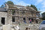
Llanrhaeadr-ym-Mochnant

Llanrhaeadr-ym-Mochnant (Welsh pronunciation) is a village, community and an ecclesiastical parish in the extreme north of Powys, Wales; about 9 miles west of Oswestry and 12 miles south of Llangollen, on the B4580. It lies near the foothills of the Berwyn mountains on the river Rhaeadr. At the top end of the valley is the Pistyll Rhaeadr waterfall, one of the Seven Wonders of Wales in the old rhyme. One mile north of the town is the hill Moel Hen-fache (515 m). The community includes the hamlet of Llanarmon Mynydd Mawr. It was an important site in the ancient commote (or cantref; sources disagree) of Mochnant, as indicated by the ym-Mochnant in its name (translates to "in Mochnant").Until 1974, Llanrhaeadr-ym-Mochnant was split into two civil parishes: the northern parish was in historic Denbighshire and the southern parish in historic Montgomeryshire; this reflected the division of the ancient commote in the 12th century. The divide continued between 1974 and 1996, with the former Denbighshire parish being placed in Clwyd and the former Montgomeryshire parish in Powys, each with their own community councils. In 1996, both parts of Llanrhaeadr-ym-Mochnant were united within the county of Powys, and the community councils were amalgamated in 2008.
Excerpt from the Wikipedia article Llanrhaeadr-ym-Mochnant (License: CC BY-SA 3.0, Authors, Images).Llanrhaeadr-ym-Mochnant
Geographical coordinates (GPS) Address Nearby Places Show on map
Geographical coordinates (GPS)
| Latitude | Longitude |
|---|---|
| N 52.83 ° | E -3.3 ° |
Address
SY10 0DL , Llanrhaeadr-ym-Mochnant
Wales, United Kingdom
Open on Google Maps


