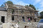
Llanarmon Mynydd Mawr
Villages in Powys

Llanarmon Mynydd Mawr, occasionally referred to as Llanarmon Fach, is an isolated rural parish in Powys, Wales. It was formerly in Denbighshire, and from 1974 to 1996 was in the county of Clwyd. It measures 2 square miles (5 km2) and has a population of 40.The scattered settlement lies on the south-facing slopes of the Berwyn Mountains in the high upper part of the Tanat Valley, at around 950 feet above sea level. Its name translates roughly as "St Garmon's church [on the] Great Mountain", distinguishing it from the village of Llanarmon Dyffryn Ceiriog, 5 miles (8 km) away in the Ceiriog Valley.
Excerpt from the Wikipedia article Llanarmon Mynydd Mawr (License: CC BY-SA 3.0, Authors, Images).Llanarmon Mynydd Mawr
B4580,
Geographical coordinates (GPS) Address Nearby Places Show on map
Geographical coordinates (GPS)
| Latitude | Longitude |
|---|---|
| N 52.841963 ° | E -3.285388 ° |
Address
B4580
SY10 0DJ , Llanrhaeadr-ym-Mochnant
Wales, United Kingdom
Open on Google Maps


