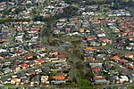
Westmeadows, Victoria

Westmeadows is a suburb in Melbourne, Victoria, Australia, 16 km (9.9 mi) north-west of Melbourne's Central Business District, located within the City of Hume local government area. Westmeadows recorded a population of 6,502 at the 2021 census.Mainly a residential suburb, Westmeadows includes the areas east and west of Mickleham Road. It borders include Yuroke Creek between Johnstone Street and Barry Road (the eastern limit), the border with Attwood (the water pipes path parallel to Toora Drive and Linga and Kenny Streets) as well as the Moonee Ponds Creek east of Mickleham Road (the northern limits) and just before the Cleanaway Landfill (the western limit). The area north of residential Westmeadows (still part of Westmeadows) contains the east–west flight path for the Melbourne Airport, Tullamarine. The land under the flight path has been kept undeveloped and is the Broadmeadows Valley Park. It contains two streams which flow into the Moonee Ponds Creek.
Excerpt from the Wikipedia article Westmeadows, Victoria (License: CC BY-SA 3.0, Authors, Images).Westmeadows, Victoria
Pascoe Street, Melbourne Westmeadows
Geographical coordinates (GPS) Address Nearby Places Show on map
Geographical coordinates (GPS)
| Latitude | Longitude |
|---|---|
| N -37.678 ° | E 144.893 ° |
Address
Pascoe Street
Pascoe Street
3049 Melbourne, Westmeadows
Victoria, Australia
Open on Google Maps


