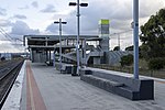
Craigieburn, Victoria

Craigieburn is a suburb in Melbourne, Victoria, Australia, 25 km (16 mi) north of Melbourne's Central Business District, located within the City of Hume local government area. Craigieburn recorded a population of 65,178 at the 2021 census.Craigieburn is a satellite suburb located on the urban-rural fringe of Melbourne, ranging from the lower half of Bridgewater Road to Mount Ridley. A large majority of the suburb is more than 200 metres above sea level, with Mount Ridley being the northernmost hill in northwestern metropolitan Melbourne with clear views of Melbourne's central business district 29.7 km away. Craigieburn is bounded by Mount Ridley Road, the Hume Freeway and Donnybrook Road in the north, Merri Creek in the east, Patullos Lane, the Craigieburn/North East railway line and a line that borders Roxburgh Park and Greenvale in the south, and Mickleham Road, Craigieburn Road and a line running north–south that borders Mickleham in the west.
Excerpt from the Wikipedia article Craigieburn, Victoria (License: CC BY-SA 3.0, Authors, Images).Craigieburn, Victoria
Coral Court, Melbourne Craigieburn
Geographical coordinates (GPS) Address Nearby Places Show on map
Geographical coordinates (GPS)
| Latitude | Longitude |
|---|---|
| N -37.594 ° | E 144.934 ° |
Address
Coral Court
Coral Court
3064 Melbourne, Craigieburn
Victoria, Australia
Open on Google Maps


