place

Sutton Cheney

Former civil parishes in LeicestershireHinckley and BosworthUse British English from July 2015Vague or ambiguous time from July 2023Villages in Leicestershire
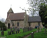
Listed buildings in the centre of Sutton Cheney

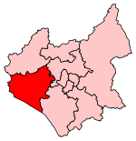
Sutton Cheney ( SUT-ən CHEE-nee) is a village and former civil parish, now in the parish of Dadlington and Sutton Cheney, in the borough of Hinckley and Bosworth, in the county of Leicestershire, England, near the county border with Warwickshire. In addition to the village of Sutton Cheney itself, the civil parish also contains the villages of Dadlington and Shenton, a number of farms, and the location of the Battle of Bosworth. Its closest large towns are Nuneaton and Hinckley. Its closest market town is Market Bosworth. The village of Sutton Cheney is clustered around the intersection of four roads: Ambion Lane leading westwards to the village of Shenton; Bosworth Road leading northwest to the neighbouring town of Market Bosworth; Main Street leading northeast to the villages of Cadeby or Stapleton; and Wharf Lane leading southwest to Sutton Cheney Wharf on the Ashby-de-la-Zouch Canal. The civil parish of Dadlington and Sutton Cheney is bordered by the civil parishes of Market Bosworth to the north; Cadeby to the northeast; Peckleton to the east; Barwell, Stoke Golding, and Higham on the Hill to the south; and Sheepy to the west. Its population at the 2021 census was 490, down from 538 in 2011 and from 545 in 2001.

Excerpt from the Wikipedia article Sutton Cheney (License: CC BY-SA 3.0, Authors, Images).

Sutton Cheney
Wharf Lane, Hinckley and Bosworth Sutton Cheney

Geographical coordinates (GPS) Address Nearby Places
placeShow on map

Wikipedia: Sutton CheneyContinue reading on Wikipedia

Geographical coordinates (GPS)

Latitude Longitude
N 52.599423 ° E -1.386251 °
placeShow on map

Address

Wharf Lane

Wharf Lane
CV13 0AL Hinckley and Bosworth, Sutton Cheney
England, United Kingdom
mapOpen on Google Maps

Listed buildings in the centre of Sutton Cheney
Share experience

Nearby Places

Ambion Hill
Ambion Hill

Ambion Hill is a hill in west Leicestershire, England, south of the town of Market Bosworth and lying south of the Sutton Cheney to Shenton road and north of Dadlington and of Fenn Lanes Roman road. The Ashby Canal passes to the south of the hill. The hill is the site of the deserted medieval village of Anebein.Ambion Hill was long considered to be the site of the Battle of Bosworth Field and is where the Bosworth Battlefield Heritage Centre is situated. The chronicler Raphael Holinshed wrote in 1577 that Richard III "pitched his field on a hill called Anne Beame, refreshed his soldiers and took his rest". This was taken by the C18th antiquary William Hutton to mean that Ambion Hill was the site of the battle. Hutton's book The Battle of Bosworth Field, published in 1788, was very influential in causing the hill to be accepted as the site of the battle.Leicestershire County Council set up the battlefield visitor centre at what was Ambion Hill Farm, in 1974. The work of Leicester University historian Daniel Williams was used to interpret the battle. Numerous historians challenged the Ambion Hill location for the battle and this led to a large-scale project (from 2005 to 2009) by the Battlefields Trust, headed by Glenn Foard, to attempt to definitively find the true location of the battlefield. It is now accepted that the core of the battlefield lies either side of Fenn Lanes, about two miles south-west of the visitor centre and that Ambion Hill was Richard III's camp on the night before the battle. The battlefield heritage centre now has a viewing point with the Fenn Lane Farm site and other notable points marked. Ambion Hill remains within the revised registered battlefield.A cairn built in 1813 marks the well from which according to tradition Richard III is said to have drunk prior to the battle. The cortège carrying Richard III's remains visited the hill during the procession before their interment in Leicester Cathedral in 2015.

Battle of Bosworth Field

The Battle of Bosworth or Bosworth Field ( BOZ-wərth) was the last significant battle of the Wars of the Roses, the civil war between the houses of Lancaster and York that extended across England in the latter half of the 15th century. Fought on 22 August 1485, the battle was won by an alliance of Lancastrians and disaffected Yorkists. Their leader Henry Tudor, Earl of Richmond, became the first English monarch of the Tudor dynasty by his victory and subsequent marriage to a Yorkist princess. His opponent Richard III, the last king of the House of York, was killed during the battle, the last English monarch to die in combat. Historians consider Bosworth Field to mark the end of the Plantagenet dynasty, making it one of the defining moments of English history. Richard's reign began in 1483 when he ascended the throne after his twelve-year-old nephew, Edward V, was declared illegitimate. The boy and his younger brother Richard soon disappeared, and their fate is a mystery still today. Across the English Channel Henry Tudor, a descendant of the greatly diminished House of Lancaster, seized on Richard's difficulties and laid claim to the throne. Henry's first attempt to invade England in 1483 foundered in a storm, but his second arrived unopposed on 7 August 1485 on the southwest coast of Wales. Marching inland, Henry gathered support as he made for London. Richard hurriedly mustered his troops and intercepted Henry's army near Ambion Hill, south of the town of Market Bosworth in Leicestershire. Lord Stanley and Sir William Stanley also brought a force to the battlefield, but held back while they decided which side it would be most advantageous to support, initially lending only four knights to Henry's cause; these were: Sir Robert Tunstall, Sir John Savage (nephew of Lord Stanley), Sir Hugh Persall and Sir Humphrey Stanley. Sir John Savage was placed in command of the left flank of Henry's army. Richard divided his army, which outnumbered Henry's, into three groups (or "battles"). One was assigned to the Duke of Norfolk and another to the Earl of Northumberland. Henry kept most of his force together and placed it under the command of the experienced Earl of Oxford. Richard's vanguard, commanded by Norfolk, attacked but struggled against Oxford's men, and some of Norfolk's troops fled the field. Northumberland took no action when signalled to assist his king, so Richard gambled everything on a charge across the battlefield to kill Henry and end the fight. Seeing the king's knights separated from his army, the Stanleys intervened; Sir William led his men to Henry's aid, surrounding and killing Richard. After the battle, Henry was crowned king. Henry hired chroniclers to portray his reign favourably; the Battle of Bosworth Field was popularised to represent his Tudor dynasty as the start of a new age, marking the end of the Middle Ages for England. From the 15th to the 18th centuries the battle was glamourised as a victory of good over evil, and features as the climax of William Shakespeare's play Richard III. The exact site of the battle is disputed because of the lack of conclusive data, and memorials have been erected at different locations. The Bosworth Battlefield Heritage Centre was built in 1974, on a site that has since been challenged by several scholars and historians. In October 2009, a team of researchers who had performed geological surveys and archaeological digs in the area since 2003 suggested a location two miles (3.2 km) southwest of Ambion Hill.