place

Western Slope, Jersey City

Neighborhoods in Jersey City, New Jersey
WesternSlope
WesternSlope

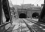
Western Slope is a neighborhood in The Heights, Jersey City, New Jersey on the cuesta, or gradual decline, of the western side of the New Jersey Palisades between The Boulevard and Tonnele Avenue. Its southern border is generally considered to be Beach Street near The Divided Highway and ramp leading to Tonnelle Circle. Its northern border is near Transfer Station, the district of Hudson County, New Jersey where Secaucus Road, Kennedy Boulevard, and Paterson Plank Road, intersect and where the borders of Jersey City Heights, North Bergen, New Jersey, and Union City, New Jersey meet at one point. Some streets of Western Slope keep their names as they cross over the city line into North Bergen. From the Tonnelle Avenue at Route 139, Tonnelle Avenue Avenue through Western Slope is also known as U.S. Route 1/9 between the Holland and Lincoln tunnels, and is dotted with motels and gas stations, and a White Manna. Some effects from erosion resulting from continued development can be seen along the eastern side of Tonnelle Avenue Avenue. The area along Tonnelle Avenue Avenue is industrial and commercial, whereas the blocks rising to the east are residential. Leonard Gordon Park at Manhattan Avenue is a neighborhood park and site of a larger than life 1907 sculpture referred to as Buffalo and Bears by Solon Hannibal Borglum. Sparrow Hill is a neighborhood is a six block stretch of Liberty Avenue between Spruce Street and Manhattan Avenue.

Excerpt from the Wikipedia article Western Slope, Jersey City (License: CC BY-SA 3.0, Authors, Images).

Western Slope, Jersey City
Arenillas, Loja

Geographical coordinates (GPS) Address Nearby Places
placeShow on map

Wikipedia: Western Slope, Jersey CityContinue reading on Wikipedia

Geographical coordinates (GPS)

Latitude Longitude
N 40.7474 ° E -74.0598 °
placeShow on map

Address

Arenillas

Arenillas
110107 Loja
Loja, Ecuador
mapOpen on Google Maps

WesternSlope
WesternSlope
Share experience

Nearby Places

Croxton, Jersey City

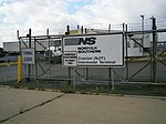
Croxton is a section of Jersey City in the New Jersey Meadowlands in Hudson County, New Jersey, United States. It is bounded by Secaucus at Penhorn Creek (named for the 17th century American colonial judge and President of the New Jersey Provincial Council and Commander-in-Chief of New Jersey, William Pinhorne). The Riverbend of the Hackensack River and the Hudson Generating Station and the Marion Section lie to the south and Truck 1-9 and Western Slope to the east. Nearby North Bergen Yard and Croxton Yard are parts of the North Jersey Shared Assets Area. The Yard is officially known as the North Jersey Intermodal Terminal.The area is informally named Croxton after Croxton Yard on the Norfolk Southern Freight Line. Much of the area is filled with New Jersey Transit commuter lines and freight lines. There are no passenger stations although Secaucus Junction is nearby. The area is home to the Metropolitan Bulk Mail Facility for New York and New Jersey. The only major road crossing the district is County Road, which connects Jersey City Heights with Secaucus. In 2005, the New Jersey Turnpike opened Exit 15X to allow access to the newly built Secaucus Junction train station, the access road to which acts like a huge U-turn, and dominates the landscape.The name Croxton was given to the railroad yard after Philip Croxton, the traffic manager for Lorillard Tobacco Company, which opened a factory at 888 Newark Avenue in the nearby Marion Section during his tenure.New Jersey Transit bus route #2 travels along County Avenue from Secaucus Junction to Journal Square.

Jersey City Reservoir No. 3

Jersey City Reservoir No. 3 is a decommissioned reservoir atop Bergen Hill in the Heights of Jersey City, Hudson County, New Jersey, United States, situated on approximately 13.8 acres (5.6 ha) just south of Pershing Field. It was built between 1871 and 1874 as part of the city's waterworks system designed to provide potable water to the city, including Ellis Island. Its perimeter wall is in the Egyptian Revival style and pump stations are in the Romanesque Revival style. The reservoir provided drinking water until the 1980s, when it was drained and abandoned for a larger reservoir at the Boonton Gorge. Since that time, a mini-ecosystem has taken root behind the thick, 20-foot tall stone walls: trees, wildflowers, swans, great blue heron, peregrine falcons, and at the center a 6-acre (2.4 ha) lake. This urban wildlife preserve hosts numerous animal and plant species not otherwise found in an urban environment. It was listed on the state and the federal registers of historic places in 2012. Nearby Reservoir No. 1 was located on either side of Summit Avenue and has been demolished.The Jersey City Reservoir Preservation Alliance, started in 2002, runs the maintenance and supervision programs necessary to keep the park open to the public every Saturday from May–October. The Alliance also runs summertime programming in arts, music, and recreation to bring new and returning community members to the space. The reservoir is also available for educational visits. The Alliance received the Ted Conrad “Preservationist of the Year” Award in 2005.Plans to make changes to the wildlife area by the city have been met with resistance from preservationists.