place

Saint Peter's Cemetery (Jersey City, New Jersey)

Cemeteries in Hudson County, New JerseyGeography of Jersey City, New JerseyRoman Catholic cemeteries in New Jersey
Saint Peter's Cemetery, Jersey City vi

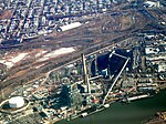
Saint Peter's Cemetery is located just south of Tonnelle Circle near Croxton Yard in Jersey City, New Jersey and is administered by Holy Name Cemetery.

Excerpt from the Wikipedia article Saint Peter's Cemetery (Jersey City, New Jersey) (License: CC BY-SA 3.0, Authors, Images).

Saint Peter's Cemetery (Jersey City, New Jersey)
Utica Street, Jersey City

Geographical coordinates (GPS) Address Nearby Places
placeShow on map

Wikipedia: Saint Peter's Cemetery (Jersey City, New Jersey)Continue reading on Wikipedia

Geographical coordinates (GPS)

Latitude Longitude
N 40.7417 ° E -74.0652 °
placeShow on map

Address

Utica Street 230
07306 Jersey City
New Jersey, United States
mapOpen on Google Maps

Saint Peter's Cemetery, Jersey City vi
Share experience

Nearby Places

Croxton, Jersey City

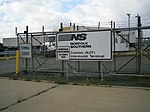
Croxton is a section of Jersey City in the New Jersey Meadowlands in Hudson County, New Jersey, United States. It is bounded by Secaucus at Penhorn Creek (named for the 17th century American colonial judge and President of the New Jersey Provincial Council and Commander-in-Chief of New Jersey, William Pinhorne). The Riverbend of the Hackensack River and the Hudson Generating Station and the Marion Section lie to the south and Truck 1-9 and Western Slope to the east. Nearby North Bergen Yard and Croxton Yard are parts of the North Jersey Shared Assets Area. The Yard is officially known as the North Jersey Intermodal Terminal.The area is informally named Croxton after Croxton Yard on the Norfolk Southern Freight Line. Much of the area is filled with New Jersey Transit commuter lines and freight lines. There are no passenger stations although Secaucus Junction is nearby. The area is home to the Metropolitan Bulk Mail Facility for New York and New Jersey. The only major road crossing the district is County Road, which connects Jersey City Heights with Secaucus. In 2005, the New Jersey Turnpike opened Exit 15X to allow access to the newly built Secaucus Junction train station, the access road to which acts like a huge U-turn, and dominates the landscape.The name Croxton was given to the railroad yard after Philip Croxton, the traffic manager for Lorillard Tobacco Company, which opened a factory at 888 Newark Avenue in the nearby Marion Section during his tenure.New Jersey Transit bus route #2 travels along County Avenue from Secaucus Junction to Journal Square.

India Square
India Square

India Square, also known as "Little India," is a commercial and restaurant district in the Journal Square and Marion Section neighborhoods of Jersey City, New Jersey. The area is home to the highest concentration of Indian Americans in the Western Hemisphere, and is a rapidly growing Indian New Yorker ethnic enclave within the New York Metropolitan Area. The neighborhood is centered on Newark Avenue, between Tonnele Avenue and JFK Boulevard, and is considered to be part of the larger Journal Square District. This area has been home to the largest outdoor Navratri festivities in New Jersey as well as several Hindu temples. This portion of Newark Avenue is lined with grocery stores including Patel Brothers and Subzi Mandi Cash & Carry, electronics vendors, video stores, clothing stores, and restaurants, and is one of the busiest pedestrian areas of this part of the city, often stopping traffic for hours. According to the 2000 census, there were nearly 13,000 Indians living in this two-block stretch in Jersey City, up from 3,000 in 1980, increasing commensurately between 2000 and 2010. As of the 2010 Census, over 27,000 Asian Indians accounted for 10.9% of Jersey City's population, the highest proportion of any major U.S. city. After dark, the businesses light flashing signs and the street crowds continue. An annual, color-filled spring Holi festival has taken place in Jersey City since 1992, centered upon India Square and attracting significant participation and international media attention. Although India Square continues to represent the heart of Little India in Jersey City, situated between Tonnele Avenue and John F. Kennedy Boulevard, Little India itself as of 2019 has been expanding further eastward along Newark Avenue, through Jersey City's Little Manila, to Summit Avenue and the Five Corners neighborhood.

Western Slope, Jersey City

Western Slope is a neighborhood in The Heights, Jersey City, New Jersey on the cuesta, or gradual decline, of the western side of the New Jersey Palisades between The Boulevard and Tonnele Avenue. Its southern border is generally considered to be Beach Street near The Divided Highway and ramp leading to Tonnelle Circle. Its northern border is near Transfer Station, the district of Hudson County, New Jersey where Secaucus Road, Kennedy Boulevard, and Paterson Plank Road, intersect and where the borders of Jersey City Heights, North Bergen, New Jersey, and Union City, New Jersey meet at one point. Some streets of Western Slope keep their names as they cross over the city line into North Bergen. From the Tonnelle Avenue at Route 139, Tonnelle Avenue Avenue through Western Slope is also known as U.S. Route 1/9 between the Holland and Lincoln tunnels, and is dotted with motels and gas stations, and a White Manna. Some effects from erosion resulting from continued development can be seen along the eastern side of Tonnelle Avenue Avenue. The area along Tonnelle Avenue Avenue is industrial and commercial, whereas the blocks rising to the east are residential. Leonard Gordon Park at Manhattan Avenue is a neighborhood park and site of a larger than life 1907 sculpture referred to as Buffalo and Bears by Solon Hannibal Borglum. Sparrow Hill is a neighborhood is a six block stretch of Liberty Avenue between Spruce Street and Manhattan Avenue.

Stanley Theater (Jersey City, New Jersey)

The Stanley Theater at Kennedy Boulevard and Pavonia Avenue is near Journal Square in Jersey City, New Jersey. The theater opened to the public on March 24, 1928. Mayor Frank Hague attended the ceremonies that evening and, with the audience, was greeted on the screen by actress Norma Talmadge. An orchestral performance, a stage show called "Sky Blues," a newsreel, and a musical piece on the Wurlitzer organ preceded the showing of The Dove starring Talmadge and Gilbert Roland. The Stanley was designed by architect Fred Wesley Wentworth (1864-1943), who is noted for designing many buildings in Paterson following the 1902 fire. When it opened, its 4,300 seats earned it the rank of the second largest theater on the East Coast, behind only New York City's Radio City Music Hall. It was fourth in the country in number of seats in a one-screen theater, behind Radio City, and the Detroit and St. Louis Fox theaters. It was an elegant and popular venue into the 1960s. Stage shows at the theater reflected the popular culture of the times with entertainers ranging from The Three Stooges and Jimmy Durante to Tony Bennett, Janis Joplin, Dolly Parton, and the Grateful Dead. During the 1970s, however, movie attendance suffered and the theater fell into disrepair, and became an RKO (Radio-Keith-Orpheum Pictures) grindhouse. The once beautiful metalwork throughout the building was painted dark blue, and the Wurlitzer organ was removed in the 1970s. It finally closed as a movie theater April 20, 1978. In 1983, the building was purchased by the Watch Tower Society for use as a convention and assembly hall for Jehovah's Witnesses. Thousands of Witness volunteers worked over a nine-month period to renovate the theater. Beginning in October 2012, the theater underwent further renovation by over 2,000 Witness volunteers from across the United States.

Five Corners, Jersey City

Five Corners is a neighborhood located at the intersection of Summit Avenue, Newark Avenue, and Hoboken Avenue in Jersey City, New Jersey, United States, and is situated in the northeastern portion of the larger Journal Square district. The name of the intersection is used for the neighborhood radiating from the crossing, which is adjacent to the Hilltop, just south of Bergen Arches and The Divided Highway. In the 19th century, the area was the crossroads where Newark Plank Road descended to either Hoboken or Paulus Hook, while Summit Avenue traveled north thorough Bergen Woods or south through Bergen Square to Communipaw.Five Corners is where the county seat of Hudson County is located. The Hudson County Courthouse is at Newark and Baldwin Avenues.40°43′53″N 74°3′29″W. The Hudson County Administration Building, at 595 Newark Avenue, is home to many county agencies and departments. The Five Corners Branch of the Jersey City Public Library is sited on the intersection itself. The (original) Jersey City High School, now William L. Dickinson High School, at 2 Palisade Avenue 40°43′48″N 74°3′16″W is nearby. The Journal Square Transportation Center, providing train (PATH) and bus (mostly from NJ Transit) service, lies just south of the intersection on Summit Avenue. India Square is located just west along Newark Avenue at Kennedy Boulevard. The many stores around the intersection create a Little Manila, including one of the first Filipino American groceries, Phil-Am Food Mart (now known as Phil-Am Merchandising and Casa Victoria), and The Filipino Channel. A popular bakery chain in the Philippines, Red Ribbon, opened its first store on the East Coast in 2006 on Summit Avenue.