place

The Heights, Jersey City

Neighborhoods in Jersey City, New Jersey
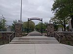
Riverview Fisk Park Jersey City November 2021 002

The Heights or Jersey City Heights is a neighborhood in Jersey City, New Jersey, located atop the New Jersey Palisades, along the west side of the Hudson River. It is bound by Paterson Plank Road on the north, Highway 139 on the south, Hoboken on the east, and the Hackensack River on the west. and Penhorn Creek on the west. Its postal area ZIP codes are 07307, and portions of 07306.

Excerpt from the Wikipedia article The Heights, Jersey City (License: CC BY-SA 3.0, Authors, Images).

The Heights, Jersey City
Lincoln Street, Jersey City

Geographical coordinates (GPS) Address Nearby Places
placeShow on map

Wikipedia: The Heights, Jersey CityContinue reading on Wikipedia

Geographical coordinates (GPS)

Latitude Longitude
N 40.747376 ° E -74.050575 °
placeShow on map

Address

Grace Lutheran Church

Lincoln Street
07307 Jersey City
New Jersey, United States
mapOpen on Google Maps

Riverview Fisk Park Jersey City November 2021 002
Share experience

Nearby Places

M.E.T.S. Charter School

M.E.T.S. Charter School (formally known Mathematics, Engineering, Technology, & Science Charter School) was a seven-year comprehensive public charter middle school / high school that serves students in sixth through twelfth grades in Hudson County and Essex County of New Jersey, United States. The M.E.T.S. Charter School had two campuses, one in Jersey City and one in Newark. The school operates under the terms of a charter granted by the New Jersey Department of Education. M.E.T.S. Charter School was an Early College Preparatory School that utilizes research-based instructional practices to achieve student proficiency in mathematics, engineering, technology, and science. M.E.T.S. Charter School encouraged students to take college level courses and graduate from high school within four years with up to 60 college credits and/or an associate degree. Postsecondary success was promoted by prioritizing admission to a four-year college or university for each member of the graduating class. In February 2020, New Jersey Commissioner of Education Lamont Repollet ordered the school to close at the end of the 2019-20 school year citing the school for "not operating in compliance with its charter".As of the 2019–20 school year, the school had an enrollment of 713 students and 43.9 classroom teachers (on an FTE basis), for a student–teacher ratio of 16.2:1. There were 451 students (63.3% of enrollment) eligible for free lunch and 53 (7.4% of students) eligible for reduced-cost lunch.

Jersey City Reservoir No. 3

Jersey City Reservoir No. 3 is a decommissioned reservoir atop Bergen Hill in the Heights of Jersey City, Hudson County, New Jersey, United States, situated on approximately 13.8 acres (5.6 ha) just south of Pershing Field. It was built between 1871 and 1874 as part of the city's waterworks system designed to provide potable water to the city, including Ellis Island. Its perimeter wall is in the Egyptian Revival style and pump stations are in the Romanesque Revival style. The reservoir provided drinking water until the 1980s, when it was drained and abandoned for a larger reservoir at the Boonton Gorge. Since that time, a mini-ecosystem has taken root behind the thick, 20-foot tall stone walls: trees, wildflowers, swans, great blue heron, peregrine falcons, and at the center a 6-acre (2.4 ha) lake. This urban wildlife preserve hosts numerous animal and plant species not otherwise found in an urban environment. It was listed on the state and the federal registers of historic places in 2012. Nearby Reservoir No. 1 was located on either side of Summit Avenue and has been demolished.The Jersey City Reservoir Preservation Alliance, started in 2002, runs the maintenance and supervision programs necessary to keep the park open to the public every Saturday from May–October. The Alliance also runs summertime programming in arts, music, and recreation to bring new and returning community members to the space. The reservoir is also available for educational visits. The Alliance received the Ted Conrad “Preservationist of the Year” Award in 2005.Plans to make changes to the wildlife area by the city have been met with resistance from preservationists.

Western Slope, Jersey City

Western Slope is a neighborhood in The Heights, Jersey City, New Jersey on the cuesta, or gradual decline, of the western side of the New Jersey Palisades between The Boulevard and Tonnele Avenue. Its southern border is generally considered to be Beach Street near The Divided Highway and ramp leading to Tonnelle Circle. Its northern border is near Transfer Station, the district of Hudson County, New Jersey where Secaucus Road, Kennedy Boulevard, and Paterson Plank Road, intersect and where the borders of Jersey City Heights, North Bergen, New Jersey, and Union City, New Jersey meet at one point. Some streets of Western Slope keep their names as they cross over the city line into North Bergen. From the Tonnelle Avenue at Route 139, Tonnelle Avenue Avenue through Western Slope is also known as U.S. Route 1/9 between the Holland and Lincoln tunnels, and is dotted with motels and gas stations, and a White Manna. Some effects from erosion resulting from continued development can be seen along the eastern side of Tonnelle Avenue Avenue. The area along Tonnelle Avenue Avenue is industrial and commercial, whereas the blocks rising to the east are residential. Leonard Gordon Park at Manhattan Avenue is a neighborhood park and site of a larger than life 1907 sculpture referred to as Buffalo and Bears by Solon Hannibal Borglum. Sparrow Hill is a neighborhood is a six block stretch of Liberty Avenue between Spruce Street and Manhattan Avenue.