place

Lower Plenty, Victoria

Suburbs of MelbourneSuburbs of the City of BanyuleUse Australian English from August 2019
Aerial perspective of Odyssey House along the Yarra Main Trail

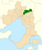
Lower Plenty is a suburb of Melbourne, Victoria, Australia, 16 km north-east from Melbourne's Central Business District, located within the City of Banyule local government area. Lower Plenty recorded a population of 3,962 at the 2021 census. Lower Plenty, in earlier times part of Eltham, almost certainly got its name from the Lower Plenty Toll Bridge, built in 1860 to collect tolls across the Plenty River. This bluestone bridge still stands as part of the Lower Plenty Trail. A report of a court case, in The Argus newspaper, dated 1 May 1879, reveals two lads, Corkhill and Hodgson, "broke the windows of the old tollhouse, Lower Plenty bridge", some 19 years after the bridge was built. The suburb is bounded by the Plenty River in the west until it joins the Yarra River, which forms the southern boundary. Fitzsimons Lane forms the eastern boundary and Airlie Road north of Main Road (a continuation of Lower Plenty Road from the west) forms the northern boundary.

Excerpt from the Wikipedia article Lower Plenty, Victoria (License: CC BY-SA 3.0, Authors, Images).

Lower Plenty, Victoria
Lower Plenty Road, Melbourne Lower Plenty

Geographical coordinates (GPS) Address Nearby Places
placeShow on map

Wikipedia: Lower Plenty, VictoriaContinue reading on Wikipedia

Geographical coordinates (GPS)

Latitude Longitude
N -37.734 ° E 145.116 °
placeShow on map

Address

Heidelberg Golf Club

Lower Plenty Road
3085 Melbourne, Lower Plenty
Victoria, Australia
mapOpen on Google Maps

Aerial perspective of Odyssey House along the Yarra Main Trail
Share experience

Nearby Places

3AK

3AK is the call sign of SEN 1116, and the earlier on-air name of a former Melbourne talk-back radio and music station, which, in 2003, leased its licence to sports network SEN 1116. A number of unusual events and precedents throughout the station's history make its story of unusual interest. These events include (but are not limited to): In lieu of a "C" class licence, the granting of a "B" class licence in 1931, but with limiting conditions including: a position on the dial that could not be picked up by most contemporary radio sets; only allowed to broadcast when other Melbourne commercial stations were off the air, that is, most of the time only at night; limited power. The founder of the station was George F. Palmer, the father of Clive Palmer. The sharing of its wavelength with 2BS Bathurst, a station that was comparatively close geographically, thus causing interference problems. From 1954, permitted to broadcast during daylight hours, but only when its signal was perceived not to interfere with that of 2BS. Purchased in 1961 by Australian Consolidated Press and thus became sister station of GTV-9. Most high-profile GTV personalities also broadcast on 3AK. When some FM licences were auctioned off to existing AM stations in 1989, 3AK became one of the two successful Melbourne bidders, but the station did not take up the offer because of ownership changes. In 1990, purchased by Peter Corso. 3AK thus became an Italian language station for some years. In late 2003 the 3AK license was leased to Sports Entertainment Network and from January 2004 it became a 24-hour sports station, using the on-air name SEN whilst having to retain 3AK as its official callsign.

Yallambie

Yallambie is a suburb of Melbourne, Victoria, Australia, 15 km north-east from Melbourne's Central Business District, located within the City of Banyule local government area. Yallambie recorded a population of 4,161 at the 2021 census. Yallambie sits in the Ivanhoe State Electorate, and shares the same postcode as neighbouring Macleod. Yallambie is a residential suburb stretched between Greensborough Road to the west and the Plenty River on its east. Its southern border is Lower Plenty Road and Yallambie Road in the north. The predominant feature in Yallambie is the Simpson Army Barracks. Originally known as the Watsonia Military Camp, it was set up during the Second World War. Yallambie is also home to the Air Force Cadets and the Defence Force School of Signals. Yallambie's residential population almost doubled when a large parcel of reserved land behind the barracks was converted to residential use following rationalisation of military facilities during the late 1980s. This parcel of land is now known as the Streeton Views Estate. During the early 2000s The Cascades, an award-winning estate, set along a natural waterway was developed and provides a central feature of cascading water for residents of nearly 80 homes within the estate. The estate also offers relaxing and peaceful surrounds for the local community with wildlife and grassed areas along the water feature. Yallambie is home to the Federal Government agency Australian Radiation Protection and Nuclear Safety Agency (ARPANSA). Yallambie has never had a post office of that name, however the Simpson Barracks Post Office opened on 31 March 1987, replacing the Macleod office open since 1923, and was closed in 1996. A Watsonia Military office was open from 1942 until 1946 and a Watsonia Camp office was open from 1948 until 1952.Yallambie is also home to Streeton Primary School, which is a combination of 2 previous schools called Watsonia South Primary School & Yallambie Primary School which is located on the old Yallambie Primary School site. Streeton is named after well known artist Arthur Streeton. Yallambie's main pre-school facility is Yallambie Park Pre-School, which is located on the same road as Streeton Primary School. Public library service is provided by Yarra Plenty Regional Library. The nearest library is at Watsonia or Rosanna.