Sheen, Staffordshire

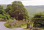
Sheen is a village and civil parish in north-east Staffordshire, England. The parish is about 3.5 miles (5.6 km) north to south and about 2 miles (3.2 km) east to west. The eastern boundary is the River Dove (the boundary with Derbyshire), and the western boundary is the River Manifold.There is a north-west to south-east ridge forming Sheen Moor; the village of Sheen, on a road running north–south through the parish, is near the southern end of the ridge. The highest point, at 380 metres (1,250 ft), is Sheen Hill. Hulme End, near the southern boundary, has height 271 metres (889 ft); Knowsley, near the northern boundary, has height 340 metres (1,120 ft). There is a steep escarpment to the River Dove in the east, and the ground falls less steeply to the River Manifold in the west. There is scattered settlement throughout the parish.The parish was described in 1851: "The face of the country is here wild and romantic, but the soil about the village is fertile and well enclosed."
Excerpt from the Wikipedia article Sheen, Staffordshire (License: CC BY-SA 3.0, Authors, Images).Sheen, Staffordshire
Pown Street, Staffordshire Moorlands Sheen
Geographical coordinates (GPS) Address Nearby Places Show on map
Geographical coordinates (GPS)
| Latitude | Longitude |
|---|---|
| N 53.1505 ° | E -1.8321 ° |
Address
Saint Luke
Pown Street
SK17 0ES Staffordshire Moorlands, Sheen
England, United Kingdom
Open on Google Maps


