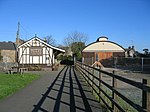
Hartington, Derbyshire
Derbyshire DalesTowns and villages of the Peak DistrictVillages in Derbyshire

Hartington is a village in the centre of the White Peak area of the Derbyshire Peak District, England, lying on the River Dove which is the Staffordshire border. According to the 2001 census, the parish of Hartington Town Quarter, which also includes Pilsbury, had a population of 345 reducing to 332 at the 2011 Census. Formerly known for cheese-making and the mining of ironstone, limestone and lead, the village is now popular with tourists.
Excerpt from the Wikipedia article Hartington, Derbyshire (License: CC BY-SA 3.0, Authors, Images).Hartington, Derbyshire
Hide Lane, Derbyshire Dales Hartington Town Quarter CP
Geographical coordinates (GPS) Address Nearby Places Show on map
Geographical coordinates (GPS)
| Latitude | Longitude |
|---|---|
| N 53.14095 ° | E -1.80846 ° |
Address
Hartington Village Hall
Hide Lane
SK17 0AP Derbyshire Dales, Hartington Town Quarter CP
England, United Kingdom
Open on Google Maps


