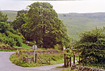
Hulme End
Hamlets in StaffordshireTowns and villages of the Peak DistrictUse British English from May 2017

Hulme End () is a small hamlet in Staffordshire, England, in the Peak District National Park 10 miles north of Ashbourne, Derbyshire. A natural gateway to the Manifold Valley, the river crosses the road from Hartington (the nearest village) to Warslow.
Excerpt from the Wikipedia article Hulme End (License: CC BY-SA 3.0, Authors, Images).Hulme End
Higgs Lane, Staffordshire Moorlands
Geographical coordinates (GPS) Address Nearby Places Show on map
Geographical coordinates (GPS)
| Latitude | Longitude |
|---|---|
| N 53.131111111111 ° | E -1.8463888888889 ° |
Address
Higgs Lane
Higgs Lane
SK17 0EZ Staffordshire Moorlands
England, United Kingdom
Open on Google Maps


