Ecton, Staffordshire
Hamlets in StaffordshireStaffordshire MoorlandsTowns and villages of the Peak DistrictUse British English from May 2013Villages in Staffordshire

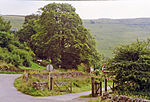
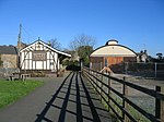
Ecton is a hamlet in the Staffordshire Peak District (grid reference SK096584). It is on the Manifold Way, an 8-mile (13 km) walk and cycle path that follows the line of the former Leek and Manifold Valley Light Railway. Population details as at the 2011 census can be found under Ilam.
Excerpt from the Wikipedia article Ecton, Staffordshire (License: CC BY-SA 3.0, Authors, Images).Ecton, Staffordshire
Ecton Road, Staffordshire Moorlands
Geographical coordinates (GPS) Address Nearby Places Show on map
Geographical coordinates (GPS)
| Latitude | Longitude |
|---|---|
| N 53.122 ° | E -1.857 ° |
Address
Ecton Road
DE6 2AJ Staffordshire Moorlands
England, United Kingdom
Open on Google Maps


