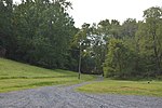
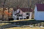
Dover, Virginia
Dover is an unincorporated community in Loudoun County, Virginia, United States. Dover is located east of Middleburg at the intersection of U.S. Route 50, Champe Ford Road (SR 629 south), and Cobb House Road (SR 629 north). The Little River begins following Route 50 at this point. Dover as a geographical entity is somewhat exaggerated, seeing as the bend in Route 50 it refers to consists of only few houses, but it has a long pedigree as a named area, appearing on state and national maps. Most likely, its status as a geographical entity stems from the fact that the Little River Turnpike (first toll road in America) and Aldie-Ashby's Gap Turnpike terminated approximately together here, 1.3 miles west of Aldie.
Excerpt from the Wikipedia article Dover, Virginia (License: CC BY-SA 3.0, Authors).Dover, Virginia
John Mosby Highway,
Geographical coordinates (GPS) Address Nearby Places Show on map
Geographical coordinates (GPS)
| Latitude | Longitude |
|---|---|
| N 38.976388888889 ° | E -77.674444444444 ° |
Address
John Mosby Highway 38449
20117
Virginia, United States
Open on Google Maps


