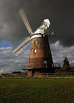
Thaxted

Thaxted is a town and civil parish in the Uttlesford district of north-west Essex, England. The town is in the valley of the River Chelmer, not far from its source in the nearby village of Debden, and is 97 metres (318 feet) above sea level (where the parish church stands).The town is 15 miles (24 km) north from the county town of Chelmsford and 5.5 miles (9 km) east from the M11 motorway. The parish contains the hamlets of Cutlers Green, Bardfield End Green, Sibleys Green, Monk Street and Richmond's Green. Much of its status as a "town" rests on its prominent late medieval guildhall, a place where guilds of skilled tradesmen regulated their trading practices, and its English Perpendicular parish church.
Excerpt from the Wikipedia article Thaxted (License: CC BY-SA 3.0, Authors, Images).Thaxted
Copthall Lane, Uttlesford Thaxted
Geographical coordinates (GPS) Address Nearby Places Show on map
Geographical coordinates (GPS)
| Latitude | Longitude |
|---|---|
| N 51.954 ° | E 0.346 ° |
Address
Copthall Lane
Copthall Lane
CM6 2LG Uttlesford, Thaxted
England, United Kingdom
Open on Google Maps


