place

List of local nature reserves in West Sussex

Featured listsGeographic coordinate listsLists of coordinatesLists of local nature reserves in the United KingdomLocal Nature Reserves in West Sussex
West Sussex-related lists
Pagham Harbour creek geograph.org.uk 230063

Local nature reserves (LNRs) are designated by local authorities under the National Parks and Access to the Countryside Act 1949. The local authority must have a legal control over the site, by owning or leasing it or having an agreement with the owner. LNRs are sites which have a special local interest either biologically or geologically, and local authorities have a duty to care for them. They can apply local bye-laws to manage and protect LNRs.As of March 2019, there are twenty-seven LNRs in West Sussex. Nine are Sites of Special Scientific Interest, six are Nature Conservation Review sites, four are Ramsar sites, two are Special Areas of Conservation, four are Special Protection Areas, one includes a scheduled monument and two are managed by the Sussex Wildlife Trust. West Sussex is in south-east England and it has a population of approximately 780,000. The county town is Chichester. In the north of the county are the heavy clays and sands of the Weald. The chalk of the South Downs runs across the centre from east to west and in the south a coastal plain runs down to the English Channel.

Excerpt from the Wikipedia article List of local nature reserves in West Sussex (License: CC BY-SA 3.0, Authors, Images).

List of local nature reserves in West Sussex
Rackham Street,

Geographical coordinates (GPS) Address Nearby Places
placeShow on map

Wikipedia: List of local nature reserves in West SussexContinue reading on Wikipedia

Geographical coordinates (GPS)

Latitude Longitude
N 50.916666666667 ° E -0.5 °
placeShow on map

Address

Rackham Street
RH20 2EY , Parham
England, United Kingdom
mapOpen on Google Maps

Pagham Harbour creek geograph.org.uk 230063
Share experience

Nearby Places

West Sussex
West Sussex

West Sussex is a ceremonial county in South East England. It is bordered by Surrey to the north, East Sussex to the east, the English Channel to the south, and Hampshire to the west. The largest settlement is Crawley, and the county town is the city of Chichester. The county has a land area of 1,991 square kilometres (769 sq mi) and a population of 858,852. Along the south coast is a near-continuous urban area which includes the towns of Bognor Regis (63,855), Littlehampton (55,706), and Worthing (111,338); the latter two are part of the Brighton and Hove built-up area, which extends into East Sussex and has a total population of 474,485. The interior of the county is generally rural; the largest towns are Crawley (118,493) and Horsham (50,934), both located in the north-east; Chichester is in the south-west and has a population of 26,795. West Sussex contains seven local government districts, which are part of a two-tier non-metropolitan county also called West Sussex. West Sussex and East Sussex were historically a single county. The South Downs are a defining feature of the county, crossing it from east to west and dividing the north and south. The downs are a chalk escarpment which falls away sharply into the Weald to the north and more gently toward the south, where there is a narrow strip of flat land between the hills and the coast. The coastal strip widens to the west, where it is punctuated by Chichester Harbour, which together with Langstone and Portsmouth harbours in neighbouring Hampshire is a ria. The county has a long history of human settlement dating back to the Lower Paleolithic era. The Romans conquered West Sussex's indigenous Britons, and incorporated the area as a Roman province. During the Early Middle Ages, the Saxons settled the area, establishing the Kingdom of Sussex in 477, which lasted until c. 827 when the kingdom was annexed by Wessex. It has a number of stately homes including Goodwood, Petworth House and Uppark, and castles such as Arundel Castle and Bramber Castle.

South Downs
South Downs

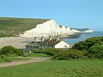
The South Downs are a range of chalk hills in the south-eastern coastal counties of England that extends for about 260 sq mi (670 km2) across the south-eastern coastal counties of England from the Itchen valley of Hampshire in the west to Beachy Head, in the Eastbourne Downland Estate, East Sussex, in the east. The Downs are bounded on the northern side by a steep escarpment, from whose crest there are extensive views northwards across the Weald. The South Downs National Park forms a much larger area than the chalk range of the South Downs, and includes large parts of the Weald. The South Downs are characterised by rolling chalk downland with close-cropped turf and dry valleys, and are recognised as one of the most important chalk landscapes in England. The range is one of the four main areas of chalk downland in southern England.The South Downs are relatively less populated compared to South East England as a whole, although there has been large-scale urban encroachment onto the chalk downland by major seaside resorts, including most notably Brighton and Hove. The South Downs have been inhabited since ancient times and at periods the area has supported a large population, particularly during Romano-British times. There is a rich heritage of historical features and archaeological remains, including defensive sites, burial mounds and field boundaries. Within the South Downs Environmentally Sensitive Area there are thirty-seven Sites of Special Scientific Interest, including large areas of chalk grassland.The grazing of sheep on the thin, well-drained chalk soils of the Downs over many centuries, and browsing by rabbits, resulted in the fine, short, springy turf, known as old chalk grassland, that has come to epitomise the South Downs today. Until the middle of the 20th century, an agricultural system operated by downland farmers known as 'sheep-and-corn farming' underpinned this: the sheep (most famously the Southdown breed) of villagers would be systematically confined to certain corn fields to improve their fertility with their droppings and then they would be let out onto the downland to graze. However, starting in 1940 with government measures during the Second World War to increase domestic food production – which continued into the 1950s - much grassland was ploughed up for arable farming, fundamentally changing the landscape and ecology, with the loss of much biodiversity. As a result, while old chalk grassland accounted for 40-50% of the eastern Downs before the war, only 3-4% survives. This and development pressures from the surrounding population centres ultimately led to the decision to create the South Downs National Park, which came into full operation on 1 April 2011, to protect and restore the Downs. The South Downs have also been designated as a National Character Area (NCA 125) by Natural England. It is bordered by the Hampshire Downs, the Wealden Greensand, the Low Weald and the Pevensey Levels to the north and the South Hampshire Lowlands and South Coast Plain to the south.The downland is a highly popular recreational destination, particularly for walkers, horseriders and mountain bikers. A long distance footpath and bridleway, the South Downs Way, follows the entire length of the chalk ridge from Winchester to Eastbourne, complemented by many interconnecting public footpaths and bridleways.

Cootham
Cootham

Cootham ( KOHT-əm, KOOT-) is a hamlet in the Horsham District of West Sussex, England. It lies on the A283 road 0.9 miles (1.4 km) west of Storrington. Cootham's population numbers around 200 and there is one public house named The Crown, parts of which date from 1555. As a well known coaching inn 'The Crown' had its own stables. They were situated on the south side of the road opposite the pub and were converted, some years ago, into houses that are known today as Crown Cottages. The hamlet lies in the lee of the South Downs, between the country estate of Parham (included in the Domesday Book) and the village of Storrington, where the nearest facilities are located. The main road running through the middle of Cootham is the A283 that runs west to Pulborough and Midhurst and east to Storrington and Washington. Items of local interest include the Southdown Gliding Club which operates flights from Parham Airfield at the western extremity of Cootham; Cootham Village Hall which hosts various local community activities and Parham House itself, one of the south east's finest country houses. Public transport is limited to one bus, Compass Travel route 100, that runs to Pulborough railway station on the Bognor Regis to London Victoria line. In the 1980s, oil was discovered beneath a large part of Cootham and a small pumping station was constructed at the corner of the gliding field. This is still operational and features two 'nodding donkey' pumps and a gas burner. Much of the area surrounding Cootham is protected from development, though housing has encroached significantly since the late 1980s and there is now little untouched land between Cootham and Storrington.