West Sussex

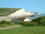
West Sussex is a ceremonial county in South East England. It is bordered by Surrey to the north, East Sussex to the east, the English Channel to the south, and Hampshire to the west. The largest settlement is Crawley, and the county town is the city of Chichester. The county has a land area of 1,991 square kilometres (769 sq mi) and a population of 858,852. Along the south coast is a near-continuous urban area which includes the towns of Bognor Regis (63,855), Littlehampton (55,706), and Worthing (111,338); the latter two are part of the Brighton and Hove built-up area, which extends into East Sussex and has a total population of 474,485. The interior of the county is generally rural; the largest towns are Crawley (118,493) and Horsham (50,934), both located in the north-east; Chichester is in the south-west and has a population of 26,795. West Sussex contains seven local government districts, which are part of a two-tier non-metropolitan county also called West Sussex. West Sussex and East Sussex were historically a single county. The South Downs are a defining feature of the county, crossing it from east to west and dividing the north and south. The downs are a chalk escarpment which falls away sharply into the Weald to the north and more gently toward the south, where there is a narrow strip of flat land between the hills and the coast. The coastal strip widens to the west, where it is punctuated by Chichester Harbour, which together with Langstone and Portsmouth harbours in neighbouring Hampshire is a ria. The county has a long history of human settlement dating back to the Lower Paleolithic era. The Romans conquered West Sussex's indigenous Britons, and incorporated the area as a Roman province. During the Early Middle Ages, the Saxons settled the area, establishing the Kingdom of Sussex in 477, which lasted until c. 827 when the kingdom was annexed by Wessex. It has a number of stately homes including Goodwood, Petworth House and Uppark, and castles such as Arundel Castle and Bramber Castle.
Excerpt from the Wikipedia article West Sussex (License: CC BY-SA 3.0, Authors, Images).West Sussex
Rackham Street,
Geographical coordinates (GPS) Address Nearby Places Show on map
Geographical coordinates (GPS)
| Latitude | Longitude |
|---|---|
| N 50.916666666667 ° | E -0.5 ° |
Address
Rackham Street
RH20 2EY , Parham
England, United Kingdom
Open on Google Maps


