place

Merry Hill, Hertfordshire

Forests and woodlands of HertfordshireHertfordshire geography stubsPopulated places in Hertfordshire
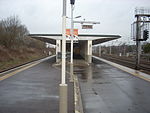
Merry Hill looking towards Carpenders Park (geograph 3129506)

Merry Hill is a 76 hectare partly wooded area in Hertfordshire, England, managed by the Woodland Trust. To the north is Oxhey and Bushey, to the west is South Oxhey and Carpenders Park, to the south is Hatch End and Harrow Weald, and to the north-west is Bushey Heath. The Woodland Trust acquired part of the site in 1996, and carried out tree-planting; part of the new woodland has been given the name Little Hartsbourne Wood. In 1998 the Trust took a lease on another area which has been planted with fruit trees.Merry Hill is also the name of a southwestern area of Bushey town.

Excerpt from the Wikipedia article Merry Hill, Hertfordshire (License: CC BY-SA 3.0, Authors, Images).

Merry Hill, Hertfordshire
Oxhey Lane, Three Rivers Carpenders Park

Geographical coordinates (GPS) Address Nearby Places
placeShow on map

Wikipedia: Merry Hill, HertfordshireContinue reading on Wikipedia

Geographical coordinates (GPS)

Latitude Longitude
N 51.631 ° E -0.37 °
placeShow on map

Address

Oxhey Lane

Oxhey Lane
WD19 5RH Three Rivers, Carpenders Park
England, United Kingdom
mapOpen on Google Maps

Merry Hill looking towards Carpenders Park (geograph 3129506)
Share experience

Nearby Places

Oxhey

Oxhey is a suburb of Watford, under the jurisdiction of the Watford Borough Council of the county of Hertfordshire, England. It is located at grid reference TQ125955 and is part of the Watford. It is in the Oxhey Ward of Watford Borough Council. Oxhey grew during the mid-19th century with the coming of the London and Birmingham Railway from London Euston to Boxmoor in 1837, the settlement being developed to house railway workers. The line was completed to Birmingham in 1838. It was originally called 'New Bushey', after the well-established village a mile away, but was renamed 'Oxhey' in 1907. Oxhey's parish church is St Matthew's, a Grade II listed building dating from 1880 in Gothic Revival style with some elements of early Art Nouveau decoration. The church also features a Karl Parsons window in the Lady Chapel.Oxhey Grange in Oxhey Lane was built in 1876 by architect William Young (1843-1900) in the High Victorian Gothic style. It is a Grade II listed building. The wider locations which comprise the modern Oxhey area are Oxhey Village (the area around Bushey station and between Pinner Road and London Road), Oxhey Hall (the area along Hampermill Lane towards Moor Park) and South Oxhey, although this is really a suburb in itself which is adjacent to Oxhey. It is an oddity that the main line station, which serves both Oxhey and the town of Bushey a mile away, is situated on the edge of Oxhey Village and yet is called Bushey Station. The original name of the station was 'Bushey', it was renamed 'Bushey & Oxhey' when Oxhey Village was renamed, and was then renamed again in 1974.