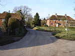
Wield
Civil parishes in HampshireEast Hampshire DistrictHampshire geography stubs

Wield is a civil parish in the East Hampshire district, in the county of Hampshire, England. It includes two neighbouring villages, Upper Wield and Lower Wield. In 2021 the parish had a population of 237.The parish council meets quarterly at the parish hall in Upper Wield.Wield as a civil parish is separate from the church parish. The parish church, dedicated to St James, is also in Upper Wield. It is mainly Norman, and is a Grade I listed building.
Excerpt from the Wikipedia article Wield (License: CC BY-SA 3.0, Authors, Images).Wield
Ferney Lane, Winchester
Geographical coordinates (GPS) Address Nearby Places Show on map
Geographical coordinates (GPS)
| Latitude | Longitude |
|---|---|
| N 51.133333333333 ° | E -1.1 ° |
Address
Ferney Lane
Ferney Lane
SO24 9RN Winchester
England, United Kingdom
Open on Google Maps


