place

Nyaania Creek

Darling RangeDarlington, Western AustraliaEastern Railway (Western Australia)Use Australian English from January 2014Watercourses of Western Australia
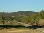
Nyannia next to former eastern railway line alignment

Nyaania Creek (31°55′S 116°03′E) is a creek in Western Australia. It is a seasonal tributary that flows into the Helena River with a catchment that moves through a number of hills suburbs just east of the Darling Scarp. Its source is in Mahogany Creek, and it flows through Glen Forrest, Darlington, and Boya before meeting the Helena River at Helena Valley. It was originally known as the Smiths Mill Brook on maps between 1902 and 1920. In the 1920s it became known as Nyaania Brook, and in 1945 it officially took the current name. Its importance stems from the fact that it flows through private land for most of its length, linked to issues that affect watercourses in the Darling Scarp region: usages of herbicides and other contaminants that can become waterborne excess nutrients from fertilisers used in domestic gardens inappropriate exotic weeds that flourish in difficult to access locations.It has significant areas of reserves either adjacent, or within 100 metres (330 ft) either side of its main creek bed. It runs in a number of places along what was rail reserve of the Eastern Railway – which is now the southern part of the Railway Reserve Heritage Trail.

Excerpt from the Wikipedia article Nyaania Creek (License: CC BY-SA 3.0, Authors, Images).

Nyaania Creek
Coulston Road, Shire Of Mundaring

Geographical coordinates (GPS) Address Nearby Places
placeShow on map

Wikipedia: Nyaania CreekContinue reading on Wikipedia

Geographical coordinates (GPS)

Latitude Longitude
N -31.91 ° E 116.05 °
placeShow on map

Address

Coulston Road

Coulston Road
6070 Shire Of Mundaring, Boya
Western Australia, Australia
mapOpen on Google Maps

Nyannia next to former eastern railway line alignment
Share experience

Nearby Places

Greenmount National Park

Greenmount National Park is a national park in the locality of Greenmount, Western Australia, 22 km east of Perth. It is one of the smaller national parks along the Darling Scarp and is a component of the Darling Range Regional Park. Due to its proximity to John Forrest National Park, which used to be known as Greenmount National Park until 1928, and relationship to subsequent reserves to the south it is a vital scarp wildlife corridor. Bus tours were available from Perth in 1933 with Hill's Bus Tours offering passengers a tour around the park on Sundays in September. Beam Transport Ltd. offered a similar service through the Park to Mundaring Weir in 1937.As a feature adjacent to the Helena River Valley it has significance in Aboriginal folklore, and also featured very early on in early European settler's diaries. Mountain Quarry is one of several blue stone quarries located within the park, popular with rock climbers and walkers. Vehicle access to the quarry site is restricted; however a car-park and picnic facilities including toilets are within walking distance of the main site, which is completely accessible on foot. There are several panels containing historical information about the site spread around as part of the popular Railway Reserves Heritage Trail, which runs close to the quarry. The Boya/Koongamia leg of the Railway Reserves Heritage Trail, also known as the "Bridle Trail", curves around the south-western edge of the park, crossing through the Mountain Quarry car-park and picnic area. In the early 2000s significant bushfire damage occurred on the southern slopes of this park. Large fire-breaks bisect the park, serving as popular walking routes among locals. The western and northern slopes, visible from Great Eastern Highway, have extensive Watsonia infestations. In late 2005, the government authority in charge of the national park was taking steps to prevent vehicular access along the top of the ridge to the lookout due to vandalism and issues with residents adjacent to the park.The park is situated along the side of Greenmount Hill and has views over the Swan Coastal Plain below and Perth to the west. The dominant vegetation in the park is eucalypts such as marri and wandoo along with an array of wild flowers and heathland along the northern slopes. The hill is steep and contain several breakaways and rocky outcrops.

Chippers Leap
Chippers Leap

Chippers Leap, formerly known as Chipper's Leap, is a granite outcrop on Greenmount Hill in Perth, Western Australia. It is located at 31º54'S 116º04'E, on the northern side of Great Eastern Highway, near the border between the suburbs of Swan View and Greenmount. Chippers Leap is named for John Chipper, who jumped from the rock on 3 February 1832 while trying to escape an attack by a party of Noongars. Chipper and an 11-year-old boy named Reuben Beacham had been driving Mr Leroux's cart from Guildford to his property in York via the York Road (now Old York Road) when they were attacked by Noongars. Chipper was speared once in the side before turning around to escape. A second spear pierced his shoulder as he jumped from the rock in order to save himself. Chipper, in his statement dated 5 February 1832, states "I heard him scream out, and I looked back, but did notice him; but perceiving a number of the natives gaining ground upon me, I turned short round the shoulder of the same hill, and ran off at my utmost speed". Chipper ran for approximately 4 miles before eventually reaching Governor James Stirling's house at Woodbridge. In the early 1930s the Main Roads Board planned a realignment of the York Road that ultimately resulted in the construction of the present Great Eastern Highway. The original plans had the road passing through Chippers Leap. After representations by the Western Australian Historical Society, the plans were changed to allow the road to pass close by the rock, thus not only preserving the rock but also increasing its visual effect and exposure. The road itself was not constructed until the 1960s. At 8:30pm on 3 February 1932, the centenary of Chipper's leap, the Western Australian Historical Society dedicated a plaque in memory of the event. Around 200 people attended a dedication ceremony at the rock. The plaque reads: ON THE 3RD OF FEBRUARY 1832. JOHN CHIPPER AND REUBEN BEACHAM A BOY OF FOURTEEN, WHILE DRIVING A CART FROM GUILDFORD TO YORK, WERE ATTACKED BY NATIVES NEAR THIS SPOT. BEACHAM WAS KILLED BUT CHIPPER ALTHOUGH SPEARED, ESCAPED AND LEAPED FROM THIS ROCK, NOW KNOWN AS CHIPPER'S LEAP, AND EVENTUALLY REACHED GOVERNOR STIRLING'S HOUSE AT WOODBRIDGE NOTE: Reuben Beacham was not 14 years of age. Reuben was born in Barnham Sussex and baptised on 20 September 1820, making him 11 and a half years old.For most of the 1960s through to the 1980s the rock face just west of the plaque featured an item of graffiti in white paint, reading "All have sinned" Towards the end of the 1990s it was replaced for a short time by "Please Turn Over". For at least the last ten years now it has been painted out and graffiti free. The plaque is adjacent to a very busy highway with no facilities for pedestrians, so it is not recommended as a stopping place at any time of day or night. A small section of parking area on the highway is available 100 metres to the west, just before a new sign "Perth Hills". It is listed on the Places Database of the Heritage Council of Western Australia, but is not afforded legislative protection. There are plaques at other sites from the same year placed by the Western Australian Historical Society, one can be found at the Round House in Fremantle There are similar granite outcrops in this area of the Darling Scarp in John Forrest National Park to the north, and to the south Darlington, and Boya, Western Australia

Darling Range Hotel
Darling Range Hotel

Darling Range Hotel was a hotel in Bellevue, Western Australia, on the end of the slope on the Great Eastern Highway at the 'bottom of' Greenmount Hill and just north of the former Bellevue railway station, and over the road from the Helena Vale Racecourse. The locality known earlier as 'Helena Vale' and 'East Midland', was near the border of the council in the hills above 'Greenmount Road Board' - (now Shire of Mundaring), and the 'Midland Junction Council' (now City of Swan). In the First World War, it was the nearest hotel to the Blackboy Hill army campIt was started as the East Midland Hotel, on the earlier name for the highway - the York Road. Despite the name the local councils called it 'The Bellevue Hotel'.The hotel was licensed in 1905, and its outward appearance changed over the years with change of owners and managers and circumstances.The owners, Licensees or Managers to the end of the First World War included:- Thomas Wilkins 1903-1913 W.K. Lamzed 1914-1916 H. Finlayson 1916-1920The longest connection on record was that of J.K. Robinson and S. Boyd 1950 -1960It was considered an excellent location and opportunity for owners and trainers with horses at the Helena Vale Racecourse.It was the base of a lengthy association with billiards and darts for the area.More historic hotels in the Midland - Bellevue area have been lost due to fire, loss of licence and neglect. The Darling Range Hotel building is one of the few remaining buildings in the area with well documented connections to the troops leaving Blackboy Hill Training Camp, and leaving Helena Vale Racecourse by railway to serve in the First World War. The building remained, with a different configuration from the first world war era, and was in potential threat of immanent demolishing to make way for a service station development, in an area that already has a significant concentration of service stations.