place

Bridgemarsh Island

Essex geography stubsIslands of EssexMaldon DistrictRiver islands of England
Bridgemarsh Creek
Bridgemarsh Creek

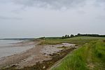
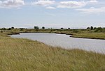
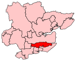
Bridgemarsh Island is in the tidal part of the River Crouch in the English county of Essex, three miles upstream from Burnham-on-Crouch. The main river channel runs to the south between the island and Canewdon, and it is separated from the mainland to the north by Bridgemarsh and Althorne Creeks, channels of the estuary. Following a flood in 1736 Bridgemarsh Island was enclosed by a sea wall and a causeway was built giving access at low tide. Farming was supplemented by industry with the island used as a source of clay. This led to the construction of a brickworks of which the chimney (at grid reference TQ890967) survives. A tramway linked these works to a quay that was used by Thames barges. Shortsightedly, no serious effort was made to maintain the sea wall. The flood of 1953 caused the end of regular occupation of the island, which is now a haven for wildlife and salt marsh flowers. It is owned by the Bridgemarsh Island Trust.

Excerpt from the Wikipedia article Bridgemarsh Island (License: CC BY-SA 3.0, Authors, Images).

Bridgemarsh Island
Essex

Geographical coordinates (GPS) Address Nearby Places
placeShow on map

Wikipedia: Bridgemarsh IslandContinue reading on Wikipedia

Geographical coordinates (GPS)

Latitude Longitude
N 51.638333333333 ° E 0.735 °
placeShow on map

Address

Latchingdon


Essex, Latchingdon
England, United Kingdom
mapOpen on Google Maps

Bridgemarsh Creek
Bridgemarsh Creek
Share experience

Nearby Places

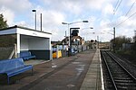
Althorne railway station

Althorne railway station is on the Crouch Valley Line in the East of England, serving the village of Althorne, Essex. It is 40 miles 27 chains (64.92 km) down the line from London Liverpool Street and is situated between North Fambridge to the west and Burnham-on-Crouch to the east. The station is managed by Greater Anglia who operate all services. The Engineer's Line Reference for line is WIS; the station's three-letter station code is ALN. The single platform, north of the running line, has an operational length for eight-coach trains. The line and station were opened on 1 June 1889 for goods and on 1 October 1889 for passenger services by the Great Eastern Railway. The facilities included a single platform with station buildings, a goods yard, and a 30-lever signal box south of the station. Two miles east of Althorne, Creeksea sidings (facing points in the "down" direction) received traffic to and from the Creeksea ferry from 1889 to 1947.Ownership passed to the London and North Eastern Railway following the Grouping of 1923, and then to the Eastern Region of British Railways upon nationalisation in 1948. When sectorisation was introduced, Althorne was served by Network SouthEast until the privatisation of British Railways. The goods yard closed on 19 December 1960, and the signal box on 21 January 1967. The level crossing to the east of the station was normally closed to road vehicles but was later converted to an automatic open crossing with lights. Electrification of the Wickford to Southminster line using 25 kV overhead line electrification (OLE) was completed on 12 May 1986.