place

Latchingdon

Maldon DistrictVillages in Essex
Latchingdon Sign geograph.org.uk 130393

Latchingdon is a village situated in the Dengie Peninsula in Essex, England, south of the city of Chelmsford. The parish was at one time called Latchingdon-cum-Snoreham, and Snoreham Hall still exists to the south of Latchingdon. The place-name 'Latchingdon' is first attested in 1065 in a charter later published in the Diplomatarium anglicum edited by Benjamin Thorpe, where it appears as Laecedune. It appears in the Domesday Book of 1086 as Lacenduna, Lachenduna and Lessenduna. The name may derive from an unrecorded Old English word *læcce from the verb læccan to catch, meaning a trap, and related to the modern word 'latch'. The name would then mean 'hill with a trap', presumably to catch animals.

Excerpt from the Wikipedia article Latchingdon (License: CC BY-SA 3.0, Authors, Images).

Latchingdon
Steeple Road, Essex

Geographical coordinates (GPS) Address Nearby Places
placeShow on map

Wikipedia: LatchingdonContinue reading on Wikipedia

Geographical coordinates (GPS)

Latitude Longitude
N 51.671278 ° E 0.726128 °
placeShow on map

Address

Steeple Road
CM3 6JX Essex, Latchingdon
England, United Kingdom
mapOpen on Google Maps

Latchingdon Sign geograph.org.uk 130393
Share experience

Nearby Places

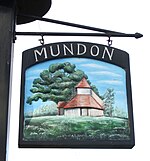
Mundon
Mundon

Mundon is a village and civil parish on the Dengie peninsula in Maldon District in the county of Essex, England. It lies 3 miles south-east of Maldon. The manor of Munduna passed from the king's thegn Godwin to Eudo Dapifer at the Norman Conquest. The place-name 'Mundon' is first attested in the Domesday Book of 1086, where it appears as Munduna. The name means 'Munda's hill'.Until the Dissolution of the Monasteries Mundon formed part of the estates of St John's Abbey, Colchester; it passed to Thomas Cromwell before being returned to the Duchy of Lancaster, which held the right of presentation to the vicarage until the 20th century.The 14th-century timber-framed Church of St. Mary, built within the remains of the moat of Mundon Hall, and likely on Saxon and Norman foundations, has been disused since the 1970s, but is currently in the care of Friends of Friendless Churches, supported by English Heritage. Following a long period of remedial work, the church re-opened to visitors in August 2009. The entire church was underpinned, and much structural work was carried out by Bakers of Danbury. The church was re-glazed, and now, internally, appears lighter than it has in recent years. It is a grade I listed building.Mundon Hall is now represented by an 18th-century farmhouse of rendered and whitewashed brick.The village was struck by an F1/T2 tornado on 23 November 1981, as part of the record-breaking nationwide tornado outbreak on that day.

Althorne railway station

Althorne railway station is on the Crouch Valley Line in the East of England, serving the village of Althorne, Essex. It is 40 miles 27 chains (64.92 km) down the line from London Liverpool Street and is situated between North Fambridge to the west and Burnham-on-Crouch to the east. The station is managed by Greater Anglia who operate all services. The Engineer's Line Reference for line is WIS; the station's three-letter station code is ALN. The single platform, north of the running line, has an operational length for eight-coach trains. The line and station were opened on 1 June 1889 for goods and on 1 October 1889 for passenger services by the Great Eastern Railway. The facilities included a single platform with station buildings, a goods yard, and a 30-lever signal box south of the station. Two miles east of Althorne, Creeksea sidings (facing points in the "down" direction) received traffic to and from the Creeksea ferry from 1889 to 1947.Ownership passed to the London and North Eastern Railway following the Grouping of 1923, and then to the Eastern Region of British Railways upon nationalisation in 1948. When sectorisation was introduced, Althorne was served by Network SouthEast until the privatisation of British Railways. The goods yard closed on 19 December 1960, and the signal box on 21 January 1967. The level crossing to the east of the station was normally closed to road vehicles but was later converted to an automatic open crossing with lights. Electrification of the Wickford to Southminster line using 25 kV overhead line electrification (OLE) was completed on 12 May 1986.

Northey Island
Northey Island

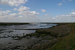
Northey Island is an island in the estuary of the River Blackwater, Essex. It is linked to the south bank of the river by a causeway, covered for two hours either side of high tide. The island is approximately 1 mile (2 km) to the east of Maldon, Essex and 1 mile (2 km) to the west of Osea Island. The Battle of Maldon, 991 is believed to have taken place on the causeway and the south bank of the Blackwater near the island. At that time the causeway is thought to have been half as long as it is presently – 120 yards rather than 240 yards today.Significant land reclamation was carried out by the Dutch contractor Nicholas Van Cropenrough in the early 18th century; he enwalled marshland to significantly enlarge the island but the walls were breached by the sea and the land returned to marshland on 29 November 1897.In 1923 Northey was bought by the writer and campaigner Norman Angell; in 1933 he was awarded the Nobel Peace Prize.The whole island and part of the bank near the causeway are now a national nature reserve. Northey is home to diverse birdlife and this is reflected in the place name 'Awl Creek' which perpetuates the traditional Essex dialect word for the Avocet.At one time Northey was home to more species than it is now. The island was one of the last southern strongholds of the raven, the last bird being taken from the Ladies grove in 1888.It is uninhabited apart from the warden. The island is owned by the National Trust and can be visited by arrangement with the warden. It is one of 43 (unbridged) tidal islands which can be walked to from the British mainland and one of six such tidal islands in Essex.

North Fambridge railway station

North Fambridge railway station is on the Crouch Valley Line in the East of England, serving the village of North Fambridge, Essex. It is 37 miles 27 chains (60.09 km) down the line from London Liverpool Street and is situated between South Woodham Ferrers to the west and Althorne to the east. The Engineer's Line Reference for the line is WIS; the station's three-letter station code is NFA. The southern (westbound) platform has an operational length for eight-coach trains while the northern (eastbound) platform can accommodate nine coaches.The line and station were opened for goods on 1 June 1889 and to passenger services on 1 October 1889 by the Great Eastern Railway. Facilities then included two platforms, both provided with buildings and linked by a footbridge; a goods yard including cattle pens; and a 30-lever signal box, reduced to 10 after 1966. The signal box was taken out of use on 1 December 1985 and demolished in February 1986. The original footbridge was replaced with a higher one prior to the electrification of the line in 1986. Electrification using 25 kV overhead line electrification (OLE) was completed on 12 May 1986. North Fambridge station is currently managed by Greater Anglia, which also operates all trains serving it. The typical off-peak service is of one westbound train every 40 minutes to Wickford and one eastbound train every 40 minutes to Southminster, with additional services at peak times. Some peak services continue to or from Shenfield and/or London Liverpool Street via the Great Eastern Main Line. As North Fambridge is at the midpoint of this single-track line, its double-track configuration provides a passing loop to allow two trains to run on the line at any one time. The station was originally called Fambridge (with the code FAM) but this was changed to North Fambridge on 20 May 2007.