place

Canewdon

Civil parishes in EssexEngvarB from July 2016Ports and harbours of EssexRochford DistrictVillages in Essex
Witchcraft in England
Canewdon sign
Canewdon sign

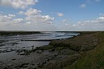
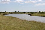
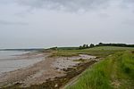
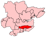
Canewdon is a village and civil parish in the Rochford district of Essex, England. The village is located approximately 4 miles (6.4 km) northeast of the town of Rochford, while the parish extends for several miles on the southern side of the River Crouch.Canewdon is situated on one of the highest hills of the Essex coastline, from which St Nicholas's Church affords wide views of the Crouch estuary. East of the village lies the island of Wallasea, popular for sailing, and a wetland sanctuary for wildlife.The name Canewdon is derived from Old English words meaning 'the hill of Cana's people' and not, as is sometimes claimed, from Canute the Great, who fought at the Battle of Ashingdon nearby in 1016 against the English King Edmund II.

Excerpt from the Wikipedia article Canewdon (License: CC BY-SA 3.0, Authors, Images).

Canewdon
Anchor Lane, Essex

Geographical coordinates (GPS) Address Nearby Places
placeShow on map

Wikipedia: CanewdonContinue reading on Wikipedia

Geographical coordinates (GPS)

Latitude Longitude
N 51.616231 ° E 0.744367 °
placeShow on map

Address

Anchor Lane

Anchor Lane
SS4 3QB Essex, Canewdon
England, United Kingdom
mapOpen on Google Maps

Canewdon sign
Canewdon sign
Share experience

Nearby Places

Althorne railway station

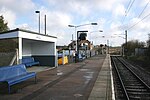
Althorne railway station is on the Crouch Valley Line in the East of England, serving the village of Althorne, Essex. It is 40 miles 27 chains (64.92 km) down the line from London Liverpool Street and is situated between North Fambridge to the west and Burnham-on-Crouch to the east. The station is managed by Greater Anglia who operate all services. The Engineer's Line Reference for line is WIS; the station's three-letter station code is ALN. The single platform, north of the running line, has an operational length for eight-coach trains. The line and station were opened on 1 June 1889 for goods and on 1 October 1889 for passenger services by the Great Eastern Railway. The facilities included a single platform with station buildings, a goods yard, and a 30-lever signal box south of the station. Two miles east of Althorne, Creeksea sidings (facing points in the "down" direction) received traffic to and from the Creeksea ferry from 1889 to 1947.Ownership passed to the London and North Eastern Railway following the Grouping of 1923, and then to the Eastern Region of British Railways upon nationalisation in 1948. When sectorisation was introduced, Althorne was served by Network SouthEast until the privatisation of British Railways. The goods yard closed on 19 December 1960, and the signal box on 21 January 1967. The level crossing to the east of the station was normally closed to road vehicles but was later converted to an automatic open crossing with lights. Electrification of the Wickford to Southminster line using 25 kV overhead line electrification (OLE) was completed on 12 May 1986.