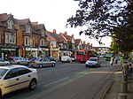
Sunnymead
Areas of OxfordOxfordshire geography stubs
Sunnymead is a suburb in the northern part of Oxford, England, just south of the Oxford Ring Road (A40). Close by are the suburbs of Cutteslowe to the north, Summertown to the south and Upper Wolvercote to the west. To the east is the River Cherwell, which flows south towards central Oxford.
Excerpt from the Wikipedia article Sunnymead (License: CC BY-SA 3.0, Authors).Sunnymead
Wentworth Road, Oxford North Oxford
Geographical coordinates (GPS) Address Nearby Places Show on map
Geographical coordinates (GPS)
| Latitude | Longitude |
|---|---|
| N 51.785 ° | E -1.266 ° |
Address
Wentworth Road 27
OX2 7TQ Oxford, North Oxford
England, United Kingdom
Open on Google Maps


