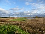
Hoath
City of CanterburyCivil parishes in KentKent geography stubsVillages in Kent

Hoath is a semi-rural village and civil parish in the City of Canterbury local government district. The hamlets of Knaves Ash, Maypole, Ford, Old Tree, Shelvingford and Stoney Acre are included in the parish.
Excerpt from the Wikipedia article Hoath (License: CC BY-SA 3.0, Authors, Images).Hoath
Marley Lane, Canterbury
Geographical coordinates (GPS) Address Nearby Places Show on map
Geographical coordinates (GPS)
| Latitude | Longitude |
|---|---|
| N 51.334 ° | E 1.163 ° |
Address
Marley Lane
Marley Lane
CT3 4JY Canterbury
England, United Kingdom
Open on Google Maps


