Hrdlořezy (Prague)
Districts of PragueEngvarB from November 2013Prague geography stubs

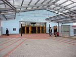
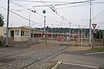
Hrdlořezy is a cadastral district in Prague. It has population of 1,666. It became part of Prague on 1 January 1922. It lies mostly in the municipal and administrative district of Prague 9 while a small part is in Prague 10. The district is bordered by Žižkov, Vysočany, Hloubětín, Kyje and Malešice.
Excerpt from the Wikipedia article Hrdlořezy (Prague) (License: CC BY-SA 3.0, Authors, Images).Hrdlořezy (Prague)
Cyklostezka Smetanka, Prague Hrdlořezy
Geographical coordinates (GPS) Address Nearby Places Show on map
Geographical coordinates (GPS)
| Latitude | Longitude |
|---|---|
| N 50.094444444444 ° | E 14.513888888889 ° |
Address
Cyklostezka Smetanka
Cyklostezka Smetanka
108 00 Prague, Hrdlořezy
Prague, Czechia
Open on Google Maps


