place

Ashland State Park

1947 establishments in MassachusettsAshland, MassachusettsMassachusetts natural resourcesParks in Middlesex County, MassachusettsProtected areas established in 1947
State parks of Massachusetts
AshlandMA AshlandParkSpillway

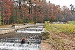
Ashland State Park is a public recreation area surrounding the 157-acre (64 ha) Ashland Reservoir in the town of Ashland, Massachusetts. The state park's 470 acres (190 ha) incorporate the entire shoreline of the reservoir, which is abutted by the Warren Conference Center and Inn of Framingham State University, town-owned land once the site of Camp Winnetaska (a Girl Scouts camp), and residential houses. The park is managed by the Massachusetts Department of Conservation and Recreation.

Excerpt from the Wikipedia article Ashland State Park (License: CC BY-SA 3.0, Authors, Images).

Ashland State Park
Presidents Row,

Geographical coordinates (GPS) Address External links Nearby Places
placeShow on map

Wikipedia: Ashland State ParkContinue reading on Wikipedia

Geographical coordinates (GPS)

Latitude Longitude
N 42.241666666667 ° E -71.466111111111 °
placeShow on map

Address

Ashland State Park

Presidents Row
01721
Massachusetts, United States
mapOpen on Google Maps

linkWikiData (Q4805274)
linkOpenStreetMap (64661)

AshlandMA AshlandParkSpillway
Share experience

Nearby Places

Framingham Reservoir No. 2 Dam and Gatehouse

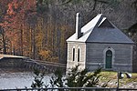
The Framingham Reservoir No. 2 Dam and Gatehouse is a historic water works facility in Framingham, Massachusetts. The dam and gatehouse are located west of the junction of Winter and Fountain Streets, and impound a branch of the Sudbury River. The reservoir, which is also known as the Brackett Reservoir, was built 1877-79 as part of an expansion of the water supply of the city of Boston. The dam is 1,376 feet (419 m) in length, with a centered overfall area. The core of the dam is granite rubble laid in cement, with earthen embankments. The overfall area is faced on the downstream side with cut granite, and earthen embankment on the upstream side. It is topped with granite and originally had iron mounts for flashboards. The gatehouse is a rectangular granite structure with a steep hip roof, a brick chimney and an eyebrow dormer. The door and windows are in round-arch openings. It contains gate controls for regulating water flow from the reservoir and from a 4-foot (1.2 m) pipe connected to Reservoir No. 1, and a 2-foot (0.61 m) pipe connected to the Ashland Reservoir.The dam was built by contractors from upstate New York, and the gatehouse was built by James Fagin of Boston to a design by the Boston city architect, George Clough. The Metropolitan Water Board, established in 1895 to oversee the city's water supply, took the reservoir out of service soon afterward due to its poor water quality.The dam and gatehouse were listed on the National Register of Historic Places in 1990.