place

Ashland, Massachusetts

Ashland, MassachusettsMetroWestPopulated places established in 1750Towns in MassachusettsTowns in Middlesex County, Massachusetts
Ashland Public Library, April 2010, MA

Ashland is a town in Middlesex County, Massachusetts, United States. It is part of the MetroWest region. The population was 18,832 at the 2020 United States census.

Excerpt from the Wikipedia article Ashland, Massachusetts (License: CC BY-SA 3.0, Authors, Images).

Ashland, Massachusetts
Concord Street,

Geographical coordinates (GPS) Address Nearby Places
placeShow on map

Wikipedia: Ashland, MassachusettsContinue reading on Wikipedia

Geographical coordinates (GPS)

Latitude Longitude
N 42.261111111111 ° E -71.463888888889 °
placeShow on map

Address

Concord Street 24-28
01721
Massachusetts, United States
mapOpen on Google Maps

Ashland Public Library, April 2010, MA
Share experience

Nearby Places

Framingham Reservoir No. 2 Dam and Gatehouse

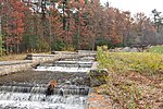
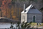
The Framingham Reservoir No. 2 Dam and Gatehouse is a historic water works facility in Framingham, Massachusetts. The dam and gatehouse are located west of the junction of Winter and Fountain Streets, and impound a branch of the Sudbury River. The reservoir, which is also known as the Brackett Reservoir, was built 1877-79 as part of an expansion of the water supply of the city of Boston. The dam is 1,376 feet (419 m) in length, with a centered overfall area. The core of the dam is granite rubble laid in cement, with earthen embankments. The overfall area is faced on the downstream side with cut granite, and earthen embankment on the upstream side. It is topped with granite and originally had iron mounts for flashboards. The gatehouse is a rectangular granite structure with a steep hip roof, a brick chimney and an eyebrow dormer. The door and windows are in round-arch openings. It contains gate controls for regulating water flow from the reservoir and from a 4-foot (1.2 m) pipe connected to Reservoir No. 1, and a 2-foot (0.61 m) pipe connected to the Ashland Reservoir.The dam was built by contractors from upstate New York, and the gatehouse was built by James Fagin of Boston to a design by the Boston city architect, George Clough. The Metropolitan Water Board, established in 1895 to oversee the city's water supply, took the reservoir out of service soon afterward due to its poor water quality.The dam and gatehouse were listed on the National Register of Historic Places in 1990.

Framingham Reservoir No. 3 Dam and Gatehouse

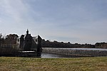
The Framingham Reservoir No. 3 Dam and Gatehouse is a historic waterworks facility in Framingham, Massachusetts. The dam and gatehouse are located at the southeastern end of Framingham Reservoir No. 3, off Massachusetts Route 9. They were built 1876–78 as part of an expansion of the public water supply of the city of Boston. The dam is 2,280 feet (690 m) long, and impounds an area of 253 acres (102 ha) in the Sudbury River watershed. The reservoir is the largest of the three Framingham reservoirs that were built at that time. The dam's core is constructed of granite rubble laid in cement. There is a granite-lined overfall area 100 feet (30 m) long, which was originally topped by flashboards. At the end of the overfall area nearest Route 9 stands the gatehouse, a granite structure with a rectangular main block and a smaller wing. Both sections have a steeply pitched slate roof. The door is in a round-arch recess, and the building is capped by a cupola. It houses controls for two 4-foot (1.2 m) mains connected to the Sudbury Aqueduct via the gatehouse at Reservoir No. 1. The water is directed either directly beyond the dam into reservoir 1 or through the 4-foot mains to the Sudbury Aqueduct gatehouse.The dam was built by contractors from Worcester, and the gatehouse was built by Benjamin Dewing of Boston to a design by the Boston city architect, George Clough. Since its construction, the reservoir, which is also known as the Foss Reservoir, has been connected by an open channel to the Sudbury Reservoir (in 1898), and had its shore areas resurfaced (in 1907–08). Nearly all of the reservoir's water comes from the Sudbury Reservoir as its own natural watershed is very limited. Of the Framingham Reservoirs, Reservoir #3 is the only one that was regularly used throughout its time as an active water source due to its better water quality than the reservoirs to the south. The reservoir is no longer in active service though it is maintained as an emergency source. It is the only one of the Framingham reservoirs still maintained as an emergency source. The dam and gatehouse were listed on the National Register of Historic Places in 1990.

Framingham Reservoir No. 1 Dam and Gatehouse

The Framingham Reservoir No. 1 Dam and Gatehouse is a historic water works facility in Framingham, Massachusetts. This complex is located at the end of Framingham Reservoir No. 1, which is also known as the Stearns Reservoir, off Winter Street and north of Long Avenue. Constructed from 1876 to 1878 as part of an expansion of the water supply of the city of Boston, this was designed by its first city architect George A. Clough. The historical purpose of the reservoir, which was located at the confluence of two branches of the Sudbury River, was primarily to control the river's water level, and secondarily to provide reserve supply capacity. The reservoir's reserve capacity was generally used only as a backup supply, as the reservoir's muddy bottom made it a less desirable source than reservoir No. 3 upstream. However the reservoir No. 1 system was nonetheless important due to its role in controlling the flow of the river downstream, and due to the gatehouse which controlled the water flows for all the Framingham reservoirs into the Sudbury Aqueduct. Reservoir No. 1 is no longer maintained as a reserve water source, although it is still owned by the Massachusetts Water Resources Authority, successor to the Boston Water Board which oversaw its construction. MWRA retains ownership as the gatehouse contains the connection between Reservoir No. 3 and the Sudbury Aqueudct which remain part of the emergency water systems.The dam measures 793 feet (242 m) in length, with an overfall area that is 169 feet (52 m) long. The embankments are 20 feet (6.1 m) wide, with a core of granite rubble laid in cement. The overfall area is topped with cut granite, and originally had wooden flashboards held in by pins. The gatehouse is a 1+1⁄2-story granite structure, designed by Boston city architect George Clough. Located at the southern end of the overfall, it houses one end of the Sudbury Aqueduct extension pipe from Farm Pond, a 4-foot (1.2 m) pipe connecting this reservoir to numbers 2 and 3, and gates for channeling water either into the aqueduct or into the river. The gates allowed water to be selectively channeled from any of the reservoirs (1, 2, or 3) into the Sudbury Aqueduct or into the river below the dam. There are also flood gates and equipment for moving the dam's flashboards. Today the gatehouse, Sudbury Aqueduct, and the pipes from reservoir number 3 remain part of MWRA's emergency systems. If activated, the water from reservoir number 3 flows from the dam number 1 gatehouse down the Sudbury Aqueduct extension pipe to a gatehouse at Farm Pond where it enters the Sudbury Aqueduct proper which in turn brings the water to the Chestnut Hill Reservoir.The dam and gatehouse were listed on the National Register of Historic Places in 1990.