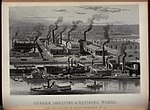
Newark Riverfront Park

Newark Riverfront Park is a park and promenade being developed in phases along the Passaic River in Newark, New Jersey, United States. The park, expected to be 3 miles (4.8 km) long and encompass 30.5 acres (12.3 ha), is being created from brownfield and greyfield sites along the river, which itself is a Superfund site due to decades of pollution. It will follow the river between the Ironbound section along Raymond Boulevard and Downtown Newark along McCarter Highway. Announced in 1999, a groundbreaking took place in 2008, and the first phase of the park opened in 2012. It was the first time residents of the largest city in New Jersey have ever had public access to the river. Other segments of the park have subsequently opened, while others are being developed. The East Coast Greenway uses paths and roads along the park.
Excerpt from the Wikipedia article Newark Riverfront Park (License: CC BY-SA 3.0, Authors, Images).Newark Riverfront Park
Raymond Boulevard, Newark
Geographical coordinates (GPS) Address Nearby Places Show on map
Geographical coordinates (GPS)
| Latitude | Longitude |
|---|---|
| N 40.7333 ° | E -74.1478 ° |
Address
Raymond Boulevard 656
07105 Newark
New Jersey, United States
Open on Google Maps


