place

Burwood East, Victoria

Suburbs of MelbourneSuburbs of the City of WhitehorseUse Australian English from August 2019
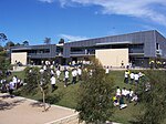
Robinson Drive, Burwood East

Burwood East is a suburb of Melbourne, Victoria, Australia, located 17 km east of Melbourne's Central Business District, located within the City of Whitehorse local government area. Burwood East recorded a population of 10,675 at the 2021 census.Burwood East is bounded by Springvale Road to the east, Middleborough Road to the west, Eley Road and Hawthorn Road to the north and Highbury Road to the south.

Excerpt from the Wikipedia article Burwood East, Victoria (License: CC BY-SA 3.0, Authors, Images).

Burwood East, Victoria
Burwood Highway, Melbourne Burwood East

Geographical coordinates (GPS) Address Nearby Places
placeShow on map

Wikipedia: Burwood East, VictoriaContinue reading on Wikipedia

Geographical coordinates (GPS)

Latitude Longitude
N -37.852 ° E 145.15 °
placeShow on map

Address

Burwood Highway 207
3151 Melbourne, Burwood East
Victoria, Australia
mapOpen on Google Maps

Robinson Drive, Burwood East
Share experience

Nearby Places

Syndal, Victoria

Syndal is a Locality in the Melbourne suburbs of Glen Waverley and Mount Waverley in Victoria, Australia around the intersection of High Street Road and Blackburn Road. It is in the local government area of the City of Monash. From the intersection down to Syndal railway station on Coleman Parade, is the Syndal Shopping Centre. This strip is a highly populated commercial area encompassing a number of diverse local interest stores including several take-away food shops, a laundromat, a bridal store, a dry cleaner and many others in between. The commercial area is renowned for many long established specialist businesses. The intersection used to have three petrol stations, three banks (the Commonwealth Bank, the State Bank of Victoria, and the Westpac Bank), and two supermarkets including Schultz's supermarket owned and run by the Brownlow Medal winner John Schultz and his brother Robert Schultz. Today, Syndal has no banks, petrol stations, or supermarkets. At one point in time there were five schools, three primary schools and two secondary schools, containing the name Syndal – The former schools of Syndal High School, Syndal Technical School, and Syndal Primary School, and the continuing Syndal North Primary School (now Mount Waverley North Primary School), and Syndal South Primary School. Syndal has a nominated Australia Post postal office, although Syndal is still part of the greater Mount Waverley and Glen Waverley suburbs, and shares the same postal code as Mount Waverley, 3149, or Glen Waverley, 3150. Syndal was originally the name of a 114-acre (0.46 km2) farm owned by Sir Redmond Barry on High Street Road, which was purchased off Barry by the Coleman family who consolidated a number of farms at the time. The name for the locality was reclaimed in 1930 when the railway line to Glen Waverley station was opened and the name for the station at Blackburn Road and Coleman Parade had to be decided. The centre of the Syndal locality, and the original Syndal property is on High Street Road, west of the Blackburn Road intersection.

Wobbies World
Wobbies World

Wobbies World was an amusement park which operated from about 1980 to the late 1990s in the Melbourne suburb of Nunawading, Australia. The park consisted of many custom-built attractions, most slow moving and aimed at very young children. The park had some characteristic modes of transport including a helicopter "Whirliebird" monorail circuit, mower motor driven 6 wheeler ATVs, a real Bell helicopter refurbished as a ground-mounted simulator, a "Splashdown" mini log ride, a mini-golf course, trampolines, a ball pit, several food and drink kiosks, a miniature train circuit, a miniature car circuit, four Melbourne W2 class trams and a large Vickers Viscount propeller plane fitted out as a movie-projector simulator. The plane now resides at the Australian National Aviation Museum, in Moorabbin, while the Bell helicopter is dismantled and currently sits in a paddock on Dandenong–Frankston Road at 38°03′57″S 145°12′02″E. One of the Whirliebird helicopters now resides in the front yard of a private residence [1] Despite memorable television advertisements over the decades, the park slowly deteriorated in the mid to late 1990s and had closed down by the end of the decade. Its demise has been linked to the high entrance fee for the time ($36 for a family of four in 1994) and the charging of separate fees to use some of the attractions.A plant nursery and the Saxon Wood town house estate occupied the Springvale Road site, but the entrance gate (without road), concrete castle, bridges, a train station, the Birthday Room and the miniature golf course from the former amusement park still remained within the nursery. In September 2012, the state government announced that a new Forest Hill police station was to be built on the site. The plant nursery had now closed. The site is now the location of the new Forest Hill Police Station.