Leire
Civil parishes in Harborough DistrictLeicestershire geography stubsUse British English from July 2015Villages in Leicestershire

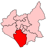
Leire is a village and civil parish in the Harborough district, in the county of Leicestershire, England. The name is thought to originate from the old British name for the river Soar, which has a tributary with a source south of the village. Present day Leire has a population of around 500, measured at 587 in the 2011 census. The village is north of Lutterworth. Today Leire has two public houses, the Queen's Arms and the Crab and Cow, as well as a church, a village hall and a riding establishment. Leire Village Hall is home to Leire pre-school group, Leire and Dunton Scout Group (which has a Beaver, Cub and Scout section) and a Pilates class.
Excerpt from the Wikipedia article Leire (License: CC BY-SA 3.0, Authors, Images).Leire
Harborough Leire
Geographical coordinates (GPS) Address Nearby Places Show on map
Geographical coordinates (GPS)
| Latitude | Longitude |
|---|---|
| N 52.507 ° | E -1.228 ° |
Address
LE17 5HE Harborough, Leire
England, United Kingdom
Open on Google Maps


