place

Kearsarge Mountain State Forest

IUCN Category VMerrimack County, New HampshireNew Hampshire geography stubsNew Hampshire state forestsNortheastern United States protected area stubs
Parks in Merrimack County, New HampshireState parks of New HampshireUse mdy dates from August 2023Warner, New HampshireWilmot, New Hampshire
Kearsarge Mtn State Forest Oct 2020

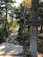
Kearsarge Mountain State Forest is a 3,893-acre (1,575 ha) state forest in the towns of Warner, Wilmot, Andover, and Salisbury, New Hampshire, United States. In 1922 it encompassed 839 acres (340 ha). The state forest covers the summit and most of the slopes of Mount Kearsarge, the highest point in Merrimack County. Winslow State Park is in the northern part of the state forest, and Rollins State Park is at the southern edge.

Excerpt from the Wikipedia article Kearsarge Mountain State Forest (License: CC BY-SA 3.0, Authors, Images).

Kearsarge Mountain State Forest
Barlow Trail,

Geographical coordinates (GPS) Address Nearby Places
placeShow on map

Wikipedia: Kearsarge Mountain State ForestContinue reading on Wikipedia

Geographical coordinates (GPS)

Latitude Longitude
N 43.383055555556 ° E -71.856944444444 °
placeShow on map

Address

Kearsarge (South) Tower

Barlow Trail

New Hampshire, United States
mapOpen on Google Maps

Kearsarge Mtn State Forest Oct 2020
Share experience

Nearby Places

Hopkins Pond (New Hampshire)

Hopkins Pond (also known as Adder Pond) is a small pond located at the south foot of Ragged Mountain, in the town of Andover, New Hampshire, United States. It lies at an elevation of 644 feet (196 m). The pond is part of Proctor Academy's 2,500-acre (10 km2) campus in Andover and is jointly managed by Proctor and the New Hampshire Fish and Game Department. The pond area is open to the public for non-motorized boat travel, fishing and hiking. This shallow pond has an average depth of 6 feet (1.8 m), is 15 feet (4.6 m) deep at the deepest point, and covers a total area of 27 acres (11 ha). It empties eastward into Mountain Brook below Elbow Pond. Mountain Brook, in turn, is a tributary of the Blackwater River, which flows via the Contoocook River and Merrimack River to the Gulf of Maine (Atlantic Ocean) at Newburyport, Massachusetts. Hopkins Pond sits within the Merrimack River watershed, and is floristically considered part of the Sunapee Uplands sub-region of the Lower New England-Northern Piedmont Ecoregion, as defined by The Nature Conservancy, and the New England-Acadian Forest Ecoregion, as defined by the World Wildlife Fund.The north shore of Hopkins Pond can be accessed from the west by Middle Hopkins Pond Trail. The south shore can be accessed from Lower Hopkins Pond Trail. Both shores can be accessed from the east by an NH Fish and Game access road off Elbow Pond Road. Observed species of fish in the pond include rainbow trout and brook trout.