place

Osmondthorpe railway station

Disused railway stations in LeedsFormer London and North Eastern Railway stationsPages with no open date in Infobox stationRailway stations in Great Britain closed in 1960Railway stations in Great Britain opened in 1930
Use British English from April 2018
Osmondthorpe Halt railway station (site), Yorkshire (geograph 3468725)

Osmondthorpe was a railway station between Leeds and Cross Gates on the Leeds to York Line (part of the Cross Country Route). It was opened as Osmondthorpe Halt by the London and North Eastern Railway in September 1930 to serve new estates being built in the area. The station was of timber construction and was built without goods facilities. After May 1937, the word Halt was dropped from the station name.The station was closed in March 1960.

Excerpt from the Wikipedia article Osmondthorpe railway station (License: CC BY-SA 3.0, Authors, Images).

Osmondthorpe railway station
Rookwood Road, Leeds Osmondthorpe

Geographical coordinates (GPS) Address External links Nearby Places
placeShow on map

Wikipedia: Osmondthorpe railway stationContinue reading on Wikipedia

Geographical coordinates (GPS)

Latitude Longitude
N 53.7994 ° E -1.4901 °
placeShow on map

Address

Osmondthorpe

Rookwood Road
LS9 0NH Leeds, Osmondthorpe
England, United Kingdom
mapOpen on Google Maps

linkWikiData (Q48817680)
linkOpenStreetMap (8606072414)

Osmondthorpe Halt railway station (site), Yorkshire (geograph 3468725)
Share experience

Nearby Places

Harehills
Harehills

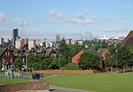
Harehills is an inner-city area of east Leeds, West Yorkshire, England. It is approximately 1 mile (1.6 km) north east of Leeds city centre. Harehills is situated between the A58 (towards Wetherby) and the A64 (towards York). It sits in the Gipton & Harehills ward of Leeds City Council and the Leeds East parliamentary constituency, between Burmantofts and Gipton, and adjacent to Chapeltown. Its boundaries are defined by the city council as "the boundary of Spencer Place to the West, Harehills Avenue to the North, the boundary of Foundry Place to the East and Compton Road and Stanley Road to the South." As the name suggests, it is a hill area, basically a south-facing slope, with many streets of terraced houses on hills. In the middle is Banstead Park, a grassy slope with trees and play areas, giving a view over the city of Leeds. There are two main shopping streets, Harehills Lane and Harehills Road which join at the junction of Roundhay Road (A58 road) leading to Oakwood. Also, heading 0.6 miles (1 km) up Harehills Lane towards the A64 York Road at the junction with Compton Road, is Harehills's other main shopping area. St James' University Hospital is situated in Harehills. Since the 1890s, cheap housing has made it attractive to immigrants, with the result that it has a considerable cultural and ethnic mixture. Harehills has high levels of unemployment in relation to Leeds and the rest of the UK.On the August Bank Holiday the Leeds Carnival is held with a procession through Harehills and Chapeltown.