place

Harehills

HarehillsPlaces in LeedsUse British English from April 2021
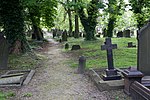
Banstead Park view 12 May 2009

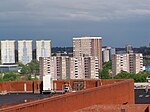
Harehills is an inner-city area of east Leeds, West Yorkshire, England. It is approximately 1 mile (1.6 km) north east of Leeds city centre. Harehills is situated between the A58 (towards Wetherby) and the A64 (towards York). It sits in the Gipton & Harehills ward of Leeds City Council and the Leeds East parliamentary constituency, between Burmantofts and Gipton, and adjacent to Chapeltown. Its boundaries are defined by the city council as "the boundary of Spencer Place to the West, Harehills Avenue to the North, the boundary of Foundry Place to the East and Compton Road and Stanley Road to the South." As the name suggests, it is a hill area, basically a south-facing slope, with many streets of terraced houses on hills. In the middle is Banstead Park, a grassy slope with trees and play areas, giving a view over the city of Leeds. There are two main shopping streets, Harehills Lane and Harehills Road which join at the junction of Roundhay Road (A58 road) leading to Oakwood. Also, heading 0.6 miles (1 km) up Harehills Lane towards the A64 York Road at the junction with Compton Road, is Harehills's other main shopping area. St James' University Hospital is situated in Harehills. Since the 1890s, cheap housing has made it attractive to immigrants, with the result that it has a considerable cultural and ethnic mixture. Harehills has high levels of unemployment in relation to Leeds and the rest of the UK.On the August Bank Holiday the Leeds Carnival is held with a procession through Harehills and Chapeltown.

Excerpt from the Wikipedia article Harehills (License: CC BY-SA 3.0, Authors, Images).

Harehills
Florentino Larrinaga,

Geographical coordinates (GPS) Address Nearby Places
placeShow on map

Wikipedia: HarehillsContinue reading on Wikipedia

Geographical coordinates (GPS)

Latitude Longitude
N 53.8066 ° E -1.5053 °
placeShow on map

Address

Florentino Larrinaga

Florentino Larrinaga
48360
Pays basque autonome, Espagne
mapOpen on Google Maps

Banstead Park view 12 May 2009
Share experience

Nearby Places

Lincoln Green
Lincoln Green

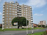
Lincoln Green is a mainly residential area of Leeds, West Yorkshire, England around Lincoln Green Road, and is adjacent to and southwest of St James's University Hospital. It falls within the Burmantofts and Richmond Hill ward of the City of Leeds Council. The area was given this name in 1954, at the start of major redevelopment by the City Council.The Lincoln Green estate on the north side of Lincoln Green Road is mainly tower blocks and low-rise flats, which replaced the terraced houses known as New Town in about 1958, following the 1950s slum clearances. On the south side of Lincoln Green Road is the Lincoln Green Shopping Centre, opened by celebrity Pat Phoenix (Elsie Tanner from Coronation Street) and community buildings and low-rise housing. There are two places of worship, the Lincoln Green Mosque, and the Christian Achiever's Faith chapel in a room above shops on Cherry Row. The one pub, the Harp, closed in June 2016: it was said to be the last genuine Irish pub in the city. A Working men's club closed in 2013 and is now demolished with plans for a supermarket on the site.Lincoln Green was one of the locations which featured in the three-part BBC series Forgotten Britain, a programme which saw Fergal Keane going to a number of struggling communities across Britain. Keane returned to the estate in 2012 and 2022 to catch up with the people he met the first time around, with the second visit becoming part of Alice Doyard's 2023 documentary Brave Britain with Fergal Keane, as broadcast by BBC One. In addition to these BBC productions, Lincoln Green was also featured in the 2009 ITV programme Seven Days on the Breadline.