Wykebeck
Places in LeedsUse British English from September 2020West Yorkshire geography stubs

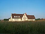
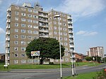
Wykebeck is an area of east Leeds, West Yorkshire, England named after the Wyke Beck and situated between Gipton and Seacroft along Wykebeck Road. The area falls within the Gipton and Harehills ward of the Leeds City Council. The area is seldom referred to, instead people usually perceive Gipton to be West of the beck and Seacroft to be East of it. The area consists of several blocks of highrise council flats to the south. Wykebeck Valley Road runs through the area, from York Road (A64) to Foundry Lane. Wykebeck Valley walking way passes to the north of the area.
Excerpt from the Wikipedia article Wykebeck (License: CC BY-SA 3.0, Authors, Images).Wykebeck
Killingbeck Bridge, Leeds Halton Moor
Geographical coordinates (GPS) Address Nearby Places Show on map
Geographical coordinates (GPS)
| Latitude | Longitude |
|---|---|
| N 53.802 ° | E -1.485 ° |
Address
Killingbeck Bridge
Killingbeck Bridge
LS14 6AT Leeds, Halton Moor
England, United Kingdom
Open on Google Maps


