Halton Moor

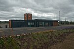
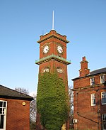
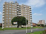
Halton Moor is a district of east Leeds, West Yorkshire, England, about three miles east of Leeds city centre close to the A63. It is situated between Killingbeck to the north, Temple Newsam to the south, Osmondthorpe to the west and Halton and Colton to the east. The area falls into the Temple Newsam ward of Leeds City Council and Leeds East parliamentary constituency. The area is mainly a council housing estate with approximately 1000 homes, made up of semi-detached houses, with some detached and terraced houses and some high rise blocks of flats. Halton Moor lies within the LS15 & LS9 postcode, with Wyke Beck forming its western boundary. In 2018, the Halton Moor Public House was demolished and will be replaced by a housing development. Many housing developments are currently being constructed in and around the estate.
Excerpt from the Wikipedia article Halton Moor (License: CC BY-SA 3.0, Authors, Images).Halton Moor
Ullswater Crescent, Leeds Halton Moor
Geographical coordinates (GPS) Address Nearby Places Show on map
Geographical coordinates (GPS)
| Latitude | Longitude |
|---|---|
| N 53.7923 ° | E -1.4821 ° |
Address
Ullswater Crescent Coronation Parade
Ullswater Crescent
LS15 0BB Leeds, Halton Moor
England, United Kingdom
Open on Google Maps


