Lievegem
East Flanders geography stubsLievegemMunicipalities of East FlandersPopulated places established in 2019

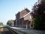
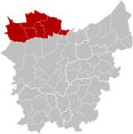
Lievegem (Dutch pronunciation: [ˈlivəˌɣɛm] (listen)) is a municipality in the Belgian province of East Flanders that arose on 1 January 2019 from the merging of the municipalities of Waarschoot, Lovendegem and Zomergem.The merged municipality has an area of 80.78 km² and is home to 26,441 inhabitants as of 2021. A referendum was held for the new name of the municipality, and 55% voted for Lievegem (literally Lieve Canal settlement).Lievegem consists of the following deelgemeentes (sub-municipalities): Lovendegem, Oostwinkel, Ronsele, Vinderhoute, Waarschoot, and Zomergem.
Excerpt from the Wikipedia article Lievegem (License: CC BY-SA 3.0, Authors, Images).Lievegem
Meirlare,
Geographical coordinates (GPS) Address Nearby Places Show on map
Geographical coordinates (GPS)
| Latitude | Longitude |
|---|---|
| N 51.13 ° | E 3.58 ° |
Address
Meirlare
Meirlare
9930 (Zomergem)
East Flanders, Belgium
Open on Google Maps


