Færder

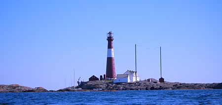
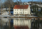
Færder is a municipality in Vestfold county, Norway. It is located in the traditional district of Vestfold. The administrative centre of the municipality is the village of Borgheim. Other villages in the municipality include Årøysund, Bjørnevåg, Buerstad, Duken, Glomstein, Grimestad, Hårkollen, Hulebakk, Kjøpmannskjær, Nesbrygga, Ormelet, Oterbekk, Skallestad, Skjerve, Solvang, Strengsdal, Sundene, Svelvik, Tenvik, Tjøme, Torød, Vestskogen, and Vollen.The 100-square-kilometre (39 sq mi) municipality is the 329th largest by area out of the 356 municipalities in Norway. Færder is the 44th most populous municipality in Norway with a population of 27,286. The municipality's population density is 273.6 inhabitants per square kilometre (709/sq mi) and its population has increased by 5.1% over the previous 10-year period.The Færder National Park, which was established in 2013, comprises islands and sea area east of the municipality. The main visitors' centre for the park is located at Verdens Ende at the southern tip of the island of Tjøme.
Excerpt from the Wikipedia article Færder (License: CC BY-SA 3.0, Authors, Images).Færder
Vindåsen, Færder
Geographical coordinates (GPS) Address Nearby Places Show on map
Geographical coordinates (GPS)
| Latitude | Longitude |
|---|---|
| N 59.17 ° | E 10.4 ° |
Address
Vindåsen 1
3145 Færder
Norway
Open on Google Maps


