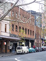
Surry Hills, New South Wales

Surry Hills is an inner-city suburb of Sydney, in the state of New South Wales, Australia. Surry Hills is immediately south-east of the Sydney central business district in the local government area of the City of Sydney. Surry Hills is surrounded by the suburbs of Darlinghurst to the north, Chippendale and Haymarket to the west, Moore Park and Paddington to the east and Redfern to the south. It is often colloquially referred to as "Surry". It is bordered by Elizabeth Street and Chalmers Street to the west, Cleveland Street to the south, South Dowling Street to the east, and Oxford Street to the north. Crown Street is a main thoroughfare through the suburb with numerous restaurants, pubs and bars. Central is a locality in the north-west of the suburb around Central station. Prince Alfred Park is located nearby. Strawberry Hills is a locality around Cleveland and Elizabeth Streets and Brickfield Hill to the east of that. A multicultural suburb, Surry Hills has had a long association with the Portuguese community of Sydney.
Excerpt from the Wikipedia article Surry Hills, New South Wales (License: CC BY-SA 3.0, Authors, Images).Surry Hills, New South Wales
Cooper Street, Sydney Surry Hills
Geographical coordinates (GPS) Address Nearby Places Show on map
Geographical coordinates (GPS)
| Latitude | Longitude |
|---|---|
| N -33.886111111111 ° | E 151.21111111111 ° |
Address
Cooper Street
Cooper Street
2010 Sydney, Surry Hills
New South Wales, Australia
Open on Google Maps


