place

Weston Ski Track

1974 establishments in MassachusettsSki areas and resorts in MassachusettsSports venues completed in 1974Weston, Massachusetts
Weston Ski Track 125 2518

Weston Ski Track (Officially known as the Leo J. Martin Ski Track) is a cross-country ski and snowshoeing area located in Weston, Massachusetts. The facility is managed by the Massachusetts Department of Conservation and Recreation and is situated along the Charles River, approximately 13 miles west of downtown Boston, Massachusetts.The ski track, open seasonally (typically December through March), provides a 2 kilometer lit ski loop with snowmaking, along with an additional 13 kilometers of groomed trails which are dependent on natural snowfall. In the warmer months, the land is used as the Leo J. Martin Golf Course.Trails at Weston Ski Track are groomed for both skate and classic techniques. The facility also serves as the home of the Eastern Massachusetts Bill Koch League junior Nordic ski program, in addition to a number of local high school, collegiate, and masters nordic ski teams in the surrounding region. Races geared towards disabled skiers and veterans have been hosted at the center, as a hub for adaptive skiing in the area. Skiers can walk across a bridge to access additional groomed trails within the town of Newton, MA. Lessons and equipment rentals are available on-site, including an indoor ski center with locker room facilities. Trails are maintained by a PistenBulley 100 groomer and LED lighting provides the opportunity for night skiing.

Excerpt from the Wikipedia article Weston Ski Track (License: CC BY-SA 3.0, Authors, Images).

Geographical coordinates (GPS)

Latitude Longitude
N 42.333333333333 ° E -71.267222222222 °
placeShow on map

Address

Leo Jerome Martin Memorial Golf Course (Martin Memorial Golf Course)

Park Road 190
02493
Massachusetts, United States
mapOpen on Google Maps

Phone number
Department of Conservation and Reservation

call+17818944903

Website
mass.gov

linkVisit website

Weston Ski Track 125 2518
Share experience

Nearby Places

Newton Lower Falls Historic District

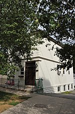
The Newton Lower Falls Historic District encompasses the historic colonial village center of Newton Lower Falls, on the west side of Newton, Massachusetts. This area lies north of Washington Street, along Concord and Grove Streets, between Washington and Hagar Streets. The district was listed on the National Register of Historic Places in 1986.The "lower falls" of the Charles River were an important geographic even before colonial days, because a Native American path traversed the area (roughly along the Washington Street alignment). In the 17th century the waterpower of the falls was already being harnessed by English colonists for the operation of gristmills and sawmills. Permanent residency on the Newton side of the river did not begin until the early 18th century, when an iron works was established. The oldest surviving house in the area is at 2345 Washington Street, built c. 1755. The residential portion of the village developed on the rise above the river, where St. Mary's Episcopal Church was built c. 1813; it is separately listed on the National Register. Adjacent to the church, a number of Greek Revival houses were built on Grove Street during the 1830s and 1840s, the height of the area's economically significant paper industry. The last significant construction in the district was the hose house (fire station) at 677 Grove Street in 1900.The historic portion of the village, once much larger, suffered a significant decline in the 20th century. Fashionable houses belonging to mill owners were demolished, as were more modest residences of mill workers, in some cases to make way for the construction of nearby Massachusetts Route 128. This intrusion also resulted in the destruction of a church and schools.