place

Wayside, New Jersey

Ocean Township, Monmouth County, New JerseyTinton Falls, New JerseyUnincorporated communities in Monmouth County, New JerseyUnincorporated communities in New JerseyUse American English from July 2023
Use mdy dates from July 2023
Wayside, NJ
Wayside, NJ

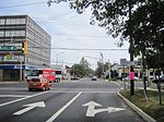
Wayside is an unincorporated community located along the border of Tinton Falls Borough and Ocean Township in Monmouth County, in the U.S. state of New Jersey. The community is largely residential though some churches, parks, and schools are located in the area. The main arterial roads in the community are Hope Road (through which the Tinton Falls–Ocean Township municipal line runs), Wayside Road (County Route 38 in Tinton Falls), and West Park Avenue. Access to New Jersey Route 18 is available via nearby interchanges with Deal Road, West Park Avenue, and Wayside Road; the Garden State Parkway's exit 105 is also located north of Wayside. The building that once housed the 16-lane Wayside Bowl-O-Drome is still in use, now as an office building.

Excerpt from the Wikipedia article Wayside, New Jersey (License: CC BY-SA 3.0, Authors, Images).

Wayside, New Jersey
Taylors Run,

Geographical coordinates (GPS) Address Nearby Places
placeShow on map

Wikipedia: Wayside, New JerseyContinue reading on Wikipedia

Geographical coordinates (GPS)

Latitude Longitude
N 40.256666666667 ° E -74.074722222222 °
placeShow on map

Address

Taylors Run 76
07712
New Jersey, United States
mapOpen on Google Maps

Wayside, NJ
Wayside, NJ
Share experience

Nearby Places

Eatontown, New Jersey

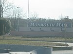
Eatontown is a borough in Monmouth County, New Jersey, United States. As of the 2010 Census, the borough's population was 12,709, reflecting a decline of 1,299 (−9.3%) from the 14,008 counted in the 2000 Census.What is now Eatontown was originally incorporated as Eatontown Township by an act of the New Jersey Legislature on April 4, 1873, from portions of Ocean Township and Shrewsbury Township. Portions of the township were taken to form West Long Branch (April 7, 1908) and Oceanport (April 6, 1920). Eatontown was reincorporated as a borough on March 8, 1926, replacing Eatontown Township, based on the results of a referendum held on April 13, 1926. The borough was named for Thomas Eaton, an early settler who built a mill c. 1670.The United States Army's Fort Monmouth operated in Eatontown from 1917 until its closure in September 2011, based on recommendations from the Base Realignment and Closure Commission. It was home to the United States Army Materiel Command's (AMC) Communication and Electronics Command (CECOM). Fort Monmouth was also home to the United States Military Academy Preparatory School (or USMAPS), which trains approximately 250 students per year to enter as freshmen (plebes) at the United States Military Academy at West Point.In the center of Eatontown is the Monmouth Mall, located at the intersection of Route 35 and Route 36, featuring a variety of stores, restaurants, and a 15-screen cineplex, with a gross leasable area of 1,500,000 square feet (140,000 m2). Celebrity chef Bobby Flay previously owned a restaurant in Eatontown.