place

Middle Branch Piscataquog River

New Hampshire river stubsRivers of Hillsborough County, New HampshireRivers of New HampshireTributaries of the Merrimack River
MidBrPiscataquog
MidBrPiscataquog

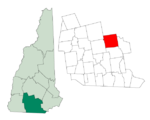
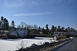
The Middle Branch of the Piscataquog River is a 10.6-mile-long (17.1 km) river in southern New Hampshire in the United States. It is a tributary of the South Branch Piscataquog River, part of the Merrimack River watershed. The Middle Branch begins at the outlet of Haunted Lake in the eastern part of Francestown. The river travels east-northeast through the town of New Boston, entering Weare, where it turns abruptly south to reenter New Boston and join the South Branch.

Excerpt from the Wikipedia article Middle Branch Piscataquog River (License: CC BY-SA 3.0, Authors, Images).

Middle Branch Piscataquog River
River Road,

Geographical coordinates (GPS) Address Nearby Places
placeShow on map

Wikipedia: Middle Branch Piscataquog RiverContinue reading on Wikipedia

Geographical coordinates (GPS)

Latitude Longitude
N 43.000833333333 ° E -71.660833333333 °
placeShow on map

Address

River Road

River Road
03070
New Hampshire, United States
mapOpen on Google Maps

MidBrPiscataquog
MidBrPiscataquog
Share experience

Nearby Places

New Boston Space Force Station

New Boston Space Force Station (BOSS) is a United States Space Force facility located in Hillsborough County in south central New Hampshire. It was transferred from the United States Air Force to the Space Force in the summer of 2020.The installation occupies more than 2,800 acres (11 km2) in three towns: New Boston, Amherst, and Mont Vernon. It was originally established in 1942 as a practice area for bombers and fighter planes from nearby Grenier Army Air Field (now Manchester–Boston Regional Airport). Starting in 1959, it was turned into a satellite-tracking station, providing the facility's most prominent feature, the weatherproof radomes which dot the hillside. BOSS has been providing support for northernly launches from KSC/Cape Canaveral for decades, and has supported the Shuttle and Titan IV programs. Since 2020 the facility has also provided line of sight telemetry tracking for commercial space launches by SpaceX.New Boston SFS is operated by the 23rd Space Operations Squadron (23 SOPS), a geographically separated unit (GSU) of Space Delta 6, part of Space Base Delta 1 at Schriever Space Force Base, Colorado. The 23rd SOPS operates and maintains the largest Satellite Control Network remote tracking station at New Boston SFS, as well as at three other GSU's located at Thule Air Base, Greenland, RAF Oakhanger, United Kingdom, and the Eastern Vehicle Checkout Facility located at Cape Canaveral, Florida. The squadron provides real-time capability to users performing on-orbit tracking, telemetry, commanding and mission data retrieval services. Additionally, the squadron provides remote command and control capability through two Global Positioning System Control stations located at Cape Canaveral and Ascension Island in the South Atlantic Ocean. The squadron also operates and maintains a Defense Satellite Communications System Heavy Earth Terminal, and additional equipment in support of the National Oceanographic Atmospheric Administration and other mission partners. The installation and infrastructure are said to be worth more than $106 million.

Goffstown Main Street Historic District

The Goffstown Main Street Historic District is a historic district encompassing the historic 19th-century center of Goffstown, New Hampshire. Most of the district's 23 buildings lie on Main Street (New Hampshire Route 114), in a 0.5-mile (0.80 km) running north from the Piscataquog River to North Mast Street (the continuation of NH 114). The district also includes properties on Depot Street and Church Street, west of Main Street. It was listed on the National Register of Historic Places in 2007.Goffstown's first town center, established when the town was first settled in the 1740s, was in what is now Grasmere Village, east of the present center. A bridge was built near the present center in 1766, to facilitate the movement of felled trees used as ship masts by the Royal Navy, and a gristmill was built adjacent to the nearby falls. The railroad arrived at that point in 1850, after which what had been "West Village" became the dominant village. A town hall was built on Main Street in 1869, which burned in 1937 and a replacement built in 1947. The public library was added in 1901, and is separately listed on the National Register. The district includes a variety of houses, many dating to the early 19th century, and a few commercial buildings along Main Street.In addition to municipal buildings, there are two churches and several railroad-related buildings. The Goffstown Congregational Church, also separately listed, is the fourth meetinghouse for a congregation founded in 1768; it is a wood-frame structure built in 1840 and given a Queen Anne restyling in the 1890s. The Methodist Episcopal Church, built in 1889, is an L-shaped wood-frame structure facing North Mast and Summer Streets. There are two train depots: a passenger-only station built in 1880, and now on the grounds of the local hardware store, and an earlier freight-and-passenger station, a utilitarian structure built in 1850 and moved onto Depot Street to make way for the second building.There are two unusual objects in the district. One is a popcorn stand, which has been used during the warmer months since the 1930s, and is now operated by the local Lion's Club. At the northwest corner of High and North Mast Streets is a 19th-century horse watering trough, which is now used as a planter.