place

Goffstown Covered Railroad Bridge

Bridges completed in 1901Bridges in Hillsborough County, New HampshireCovered bridges in the United States destroyed by arsonCovered bridges on the National Register of Historic Places in New HampshireGoffstown, New Hampshire
National Register of Historic Places in Hillsborough County, New HampshirePratt truss bridges in the United StatesRailroad bridges on the National Register of Historic Places in New HampshireWooden bridges in New Hampshire
GoffstownNH Bridges
GoffstownNH Bridges

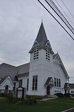
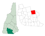
The Goffstown Covered Railroad Bridge was a rare railroad covered bridge in Goffstown, New Hampshire. It was built in 1901 by the Boston and Maine Railroad, on the site of an earlier bridge built in 1850 by the New Hampshire Central Railroad, and carried its tracks across the Piscataquog River in the center of Goffstown. The bridge was listed on the National Register of Historic Places in 1975. It was destroyed by arson in 1976, as would later be the case with the Hillsborough Railroad Bridge in 1985.

Excerpt from the Wikipedia article Goffstown Covered Railroad Bridge (License: CC BY-SA 3.0, Authors, Images).

Goffstown Covered Railroad Bridge
Goffstown Rail Trail,

Geographical coordinates (GPS) Address Nearby Places
placeShow on map

Wikipedia: Goffstown Covered Railroad BridgeContinue reading on Wikipedia

Geographical coordinates (GPS)

Latitude Longitude
N 43.018172 ° E -71.599145 °
placeShow on map

Address

Goffstown Rail Trail

Goffstown Rail Trail
03045
New Hampshire, United States
mapOpen on Google Maps

GoffstownNH Bridges
GoffstownNH Bridges
Share experience

Nearby Places

Goffstown Main Street Historic District

The Goffstown Main Street Historic District is a historic district encompassing the historic 19th-century center of Goffstown, New Hampshire. Most of the district's 23 buildings lie on Main Street (New Hampshire Route 114), in a 0.5-mile (0.80 km) running north from the Piscataquog River to North Mast Street (the continuation of NH 114). The district also includes properties on Depot Street and Church Street, west of Main Street. It was listed on the National Register of Historic Places in 2007.Goffstown's first town center, established when the town was first settled in the 1740s, was in what is now Grasmere Village, east of the present center. A bridge was built near the present center in 1766, to facilitate the movement of felled trees used as ship masts by the Royal Navy, and a gristmill was built adjacent to the nearby falls. The railroad arrived at that point in 1850, after which what had been "West Village" became the dominant village. A town hall was built on Main Street in 1869, which burned in 1937 and a replacement built in 1947. The public library was added in 1901, and is separately listed on the National Register. The district includes a variety of houses, many dating to the early 19th century, and a few commercial buildings along Main Street.In addition to municipal buildings, there are two churches and several railroad-related buildings. The Goffstown Congregational Church, also separately listed, is the fourth meetinghouse for a congregation founded in 1768; it is a wood-frame structure built in 1840 and given a Queen Anne restyling in the 1890s. The Methodist Episcopal Church, built in 1889, is an L-shaped wood-frame structure facing North Mast and Summer Streets. There are two train depots: a passenger-only station built in 1880, and now on the grounds of the local hardware store, and an earlier freight-and-passenger station, a utilitarian structure built in 1850 and moved onto Depot Street to make way for the second building.There are two unusual objects in the district. One is a popcorn stand, which has been used during the warmer months since the 1930s, and is now operated by the local Lion's Club. At the northwest corner of High and North Mast Streets is a 19th-century horse watering trough, which is now used as a planter.

Uncanoonuc Mountains

The Uncanoonuc Mountains are two small mountain peaks in Goffstown, New Hampshire, United States. The north peak, the highest point in Goffstown, has an elevation of 1,324 feet (404 m) above sea level, and the south peak rises to 1,321 feet (403 m).The name may be derived from the Massachusett language term kuncannowet (Massachusett for 'breast').The area was developed in the early 1900s as a resort with a hotel and incline railway. The mountains are still a good spot for hiking, snowshoeing, and scenic views of the nearby skyline of Manchester, as well as Mount Monadnock, Mount Kearsarge, and even, on a clear day, the faint skyline of Boston. They were the site of a small ski operation in the 1930s and 1940s, served by the incline railway that went up the south peak. With three main trails from top to bottom, it was a popular ski destination until 1941, when the railway was damaged by a fire. The incline railway has since been converted to a hiking trail.A new development was planned in the 1960s for the north peak, commencing in 1963. Chairlift and snow making equipment was ordered, several trails were cleared, but the project was halted by the town of Goffstown because of environmental concerns. In response to the failure, the city of Manchester opened its own area, McIntyre, in 1971.The south peak contains transmitting facilities for many of the broadcast stations, including WMUR-TV, serving the Manchester area.