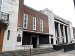
Stoke Newington Church Street
Odonyms referring to a buildingOdonyms referring to religionStoke NewingtonStreets in the London Borough of HackneyUse British English from November 2017

Stoke Newington Church Street is a road in north London of the borough of Hackney. The road links Green Lanes (A105) in the west to Stoke Newington High Street (the A10, formerly Ermine Street), in the east. Stoke Newington is one of the villages swallowed by the growth of London in the 19th century, and Church Street retains some of this neighbourhood feel, with many restaurants, pubs, and independent (non-chain) shops.
Excerpt from the Wikipedia article Stoke Newington Church Street (License: CC BY-SA 3.0, Authors, Images).Stoke Newington Church Street
Stoke Newington Church Street, London Stoke Newington (London Borough of Hackney)
Geographical coordinates (GPS) Address Nearby Places Show on map
Geographical coordinates (GPS)
| Latitude | Longitude |
|---|---|
| N 51.561111111111 ° | E -0.0825 ° |
Address
Stoke Newington Church Street 171
N16 0JU London, Stoke Newington (London Borough of Hackney)
England, United Kingdom
Open on Google Maps


