Strathtulloh, Victoria
Melbourne geography stubsSuburbs of MelbourneSuburbs of the City of MeltonUse Australian English from August 2019

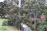
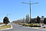
Strathtulloh is a suburb in Melbourne, Victoria, Australia, 33 km (21 mi) west of Melbourne's Central Business District, located within the City of Melton local government area. Strathtulloh recorded a population of 3,997 at the 2021 census.The suburb was gazetted by the Office of Geographic Names on 9 February 2017, following a proposal for eleven new suburbs by the City of Melton. The new name officially came into effect on 23 August 2017.Prior to the suburb's creation, the area was part of Melton South. Strathtulloh is the name of a heritage-listed property in the suburb, located on Greigs Road.
Excerpt from the Wikipedia article Strathtulloh, Victoria (License: CC BY-SA 3.0, Authors, Images).Strathtulloh, Victoria
Ferris Road, Melbourne Strathtulloh
Geographical coordinates (GPS) Address Nearby Places Show on map
Geographical coordinates (GPS)
| Latitude | Longitude |
|---|---|
| N -37.734722222222 ° | E 144.59583333333 ° |
Address
Ferris Road
Ferris Road
3338 Melbourne, Strathtulloh
Victoria, Australia
Open on Google Maps


