place

Canterbury Road

England road stubsOxfordshire geography stubsSt Hugh's College, OxfordStreets in OxfordUse British English from March 2017
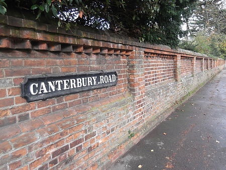
Canterbury Road wall, Oxford

Canterbury Road is a road in North Oxford, England. It runs between Woodstock Road to the west and Banbury Road to the east. Winchester Road leads south from halfway along Canterbury Road, linking with Bevington Road that runs parallel to the south. Also to the south are North Parade and Church Walk. To the north is St Hugh's College, one of the former women's colleges of the University of Oxford (now mixed), fronting onto St Margaret's Road to the north and also stretching between Woodstock Road and Banbury Road. There are some modern ornamental iron gates opposite the junction with Winchester Road, giving access to the college grounds. The Eastern Orthodox Church of the Holy Trinity and the Annunciation, built in 1973, is at 1 Canterbury Road.The area was formerly part of the estate of St John's College, Oxford, and the road is named after the city of Canterbury in honour of the former Archbishops of Canterbury who were also Presidents of the College (William Laud and William Juxon). The road contains large expensive brick-built Gothic-style detached residences. They were designed by Frederick Codd in the 1870s and leased between 1873 and 1884. These houses have been described as "Codd at his best" by Pevsner.

Excerpt from the Wikipedia article Canterbury Road (License: CC BY-SA 3.0, Authors, Images).

Canterbury Road
Canterbury Road, Oxford North Oxford

Geographical coordinates (GPS) Address Nearby Places
placeShow on map

Wikipedia: Canterbury RoadContinue reading on Wikipedia

Geographical coordinates (GPS)

Latitude Longitude
N 51.76537 ° E -1.26212 °
placeShow on map

Address

Canterbury Road 2
OX2 6LU Oxford, North Oxford
England, United Kingdom
mapOpen on Google Maps

Canterbury Road wall, Oxford
Share experience

Nearby Places

Bevington Road
Bevington Road

Bevington Road is a residential road in central North Oxford, England.The road runs between Woodstock Road (opposite Observatory Street) to the west and Banbury Road to the east. Winchester Road leads north from halfway along Bevington Road. The road was previously known as Horse and Jockey Road. A public house opposite the eastern end of the road on Woodstock Road on the corner with St Bernard's Road, called the Horse and Jockey, was a reminder of this name. In the 1850s there was a plan to run a railway line just to the north of the road, but this never materialised. The houses are in the traditional North Oxford brick-built Victorian Gothic style, dating from 1865 to 1875. Plots on the south side of the road were sold in August 1865 by St John's College, which own much of the land in the area. Architects of the houses include Frederick Codd and William Wilkinson.To the south is St Anne's College, one of the former women's colleges of the University of Oxford, fronting onto Woodstock Road and backing onto Banbury Road. All of the properties fronting onto the south side of Bevington Road are property of St Anne's College, and most are used for undergraduate accommodation.To the north is St Antony's College, a graduate college of the University, between Woodstock Road and Winchester Road. The Animal Behaviour Research Group of Oxford University, begun in 1949 on the arrival in Oxford of Niko Tinbergen, was located at 13 Bevington Road from 1961 to 1971. Prominent members of the group included Richard Dawkins and Desmond Morris. Dawkins conducted programming experiments on an early PDP-8 mini-computer here.The road is one-way to traffic from Banbury Road to Woodstock Road.