Kemps Mill, Maryland
Census-designated places in MarylandCensus-designated places in Washington County, MarylandUnincorporated communities in MarylandUnincorporated communities in Washington County, MarylandUse mdy dates from July 2023 ... and 1 more
Washington County, Maryland geography stubs

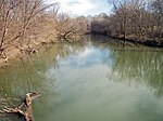
Kemps Mill is an unincorporated community and census-designated place in Washington County, Maryland, United States. Its population was 126 as of the 2010 census. It is named after a 1739 built mill structure which still stands in 2020 and has operated under a variety of names through almost three centuries. The mill dam creates a slackwater which is popular for fishing and other recreational water activities. The mill is several miles above the mouth of the Conococheague Creek which flows to the Potomac River at a location where Native American trading posts existed for many centuries prior to European settlement in the area.
Excerpt from the Wikipedia article Kemps Mill, Maryland (License: CC BY-SA 3.0, Authors, Images).Kemps Mill, Maryland
Rock Hill Road,
Geographical coordinates (GPS) Address Nearby Places Show on map
Geographical coordinates (GPS)
| Latitude | Longitude |
|---|---|
| N 39.626944444444 ° | E -77.813888888889 ° |
Address
Rock Hill Road
Rock Hill Road
21795
Maryland, United States
Open on Google Maps


