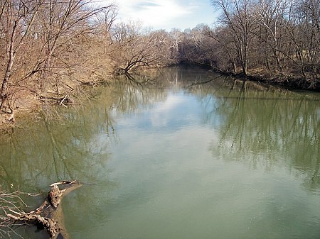
Conococheague Creek

Conococheague Creek, a tributary of the Potomac River, is a free-flowing stream that originates in Pennsylvania and empties into the Potomac River near Williamsport, Maryland. It is 80 miles (129 km) in length, with 57 miles (92 km) in Pennsylvania and 23 miles (37 km) in Maryland. The watershed of Conococheague Creek has an area of approximately 566 square miles (1,470 km2), out of which only 65 square miles (170 km2) (12% of the area) are in Maryland. The word "Conococheague" is translated from the Delaware Indian or Unami-Lenapi term òk'chaxk'hanna, which means "many-turns-river." The Conococheague, or Connogochegue, as it was known at the time, was the northernmost extent of the range along the Potomac within which Congress in the Residence Bill of 1790 authorized the establishment of the Federal District, known as the District of Columbia. By presidential proclamation, George Washington placed the District at the lower end of the range, near the "Eastern Branch", later Anacostia River, which marked the southernmost extent of the Residence Bill's range. The water divide between Conococheague Creek and Conodoguinet Creek is sometimes used as the boundary between the Hagerstown Valley and the Cumberland Valley.
Excerpt from the Wikipedia article Conococheague Creek (License: CC BY-SA 3.0, Authors, Images).Conococheague Creek
US 11,
Geographical coordinates (GPS) Address Nearby Places Show on map
Geographical coordinates (GPS)
| Latitude | Longitude |
|---|---|
| N 39.600555555556 ° | E -77.828333333333 ° |
Address
US 11
21795
Maryland, United States
Open on Google Maps


